
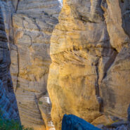
Northeast of the Southern Utah town of Kanab, a surprise slot canyon called Lick Wash is located along Skutumpah Road. It’s 15 miles on twisty, dirty ranch road to get there, but the reward is well worth the adventure. This is the Paria-Escalante region of the national monument, beneath the Pink Cliffs. You will even find pink colored stones and pebbles in the...
Learn More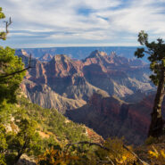
Located on the very southern tip of the Kaibab Plateau, and the prime vista location for the North Rim of Grand Canyon, Bright Angel Point offers a bird’s-eye view of the meeting of Roaring Springs Canyon and Transept Canyon at the Bright Angel Fault. It is 4/10 mile from Grand Canyon Lodge to the point on a paved trail that offers several overlooks along the way....
Learn More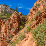
The North Rim of the Grand Canyon doesn’t get nearly the traffic as its more touristy neighbor to the south. For one thing, it is a lot more remote. The North Kaibab Trail is the most difficult of the three trails that dissect the canyon, but it also holds the most varied ecosystem. Somewhat surprisingly, it is forested. With fir and aspen and scrub oak, along with...
Learn More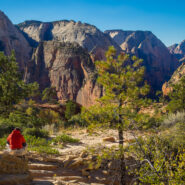
Angels Landing is a unique fin sandstone monolith that erupts 1,500 feet from the floor of Zion Canyon. The trail to the top is one of the most popular hikes in Zion National Park, certainly the most thrilling. For someone like me with heights and edges phobia and vertigo, it’s a little too much excitement, but there is a compromise. You can still enjoy most of the...
Learn More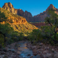
The only trail in Zion National Park that is suitable for wheelchairs, allows your pets to join you, and is also bicycle friendly. Pa’rus is from a Paiute word meaning “bubbling, tumbling water.” Both Oak Creek and Pine Creek cross this paved pathway that winds along the Virgin River between the Visitor Center and Canyon Junction. Ideal for start of day...
Learn More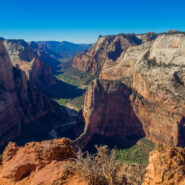
Mount Baldy surveys Zion Canyon at 6,521 feet elevation, more than 2,100 feet above the valley floor. Jutting out from Mt. Baldy into one of the widest sections of Zion Canyon, Observation Point commands a view of nearly every major attraction, particularly those like Angels Landing and The Organ at Big Bend. Hikers receive a spectacular vista of the lower end of Zion...
Learn More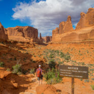
Within Arches National Park you will discover a landscape of contrasting colors, landforms and textures unlike any other in the world. The park has over 2,000 natural stone arches, in addition to hundreds of soaring pinnacles, massive fins and giant balanced rocks. This red rock wonderland will amaze you with its formations, refresh you with its trails, and inspire you...
Learn More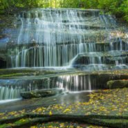
Looking for an easy hike of less than five miles that will take you to several different waterfalls? Yes? Then this just might be the one for you. It starts on the ever popular Cat Gap Trail, passes two falls on Cedar Rock Creek and a whitewater cascade on John Branch before hopping on the Butter Gap Trail to follow Grogan Creek through Picklesimer Fields to the truly...
Learn More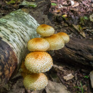
Start your morning with the elk rut in Cataloochee Valley. Then gear up for this enchanting deep forest hike that includes mountain creek crossings, giant old growth tulip poplar and hemlock, occasional views of the Smoky Mountains surrounding the valley, and a stroll down memory lane at historic settler homesteads. Enjoy this 10-mile loop in three segments, on three...
Learn More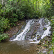
The Deep Creek area in the Smokies, just north of Bryson City, NC, is a water wonderland. Creeks and branches descend through every nook down the surrounding mountains. The documentarian Ken Burns describes Deep Creek as one of his favorite places to visit in the national park. Three picturesque waterfalls are in close proximity to the campground, and hiking trails...
Learn More
Located in an area of Polk County, NC between Tryon and Saluda, the Norman Wilder Forest is a conservation easement that first opened to the public in 2001. Owned and operated by the Pacolet Area Conservancy, the 185 acres of protected mature third growth mixed hardwood forest provide hikers with a small trail system that meanders beneath the shady canopy. Lying on the...
Learn More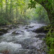
Water. Forest. Mountains. History. For me, that is what Great Smoky Mountains National Park is all about. On the Smokemont Loop hike you will get all of them. For the first couple miles, stroll along one of those beautiful mountain streams the Smokies are known for, then prepare your legs and lungs for a tough climb 1,350 feet through the forest to the top of the ridge....
Learn More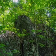
Another foray into the Black Mountains led us to summits with names like Point Misery, Little Butt and Big Butt. The Big Butt Trail takes off from Balsam Gap on the Blue Ridge Parkway along Brush Fence Ridge, roller-coastering across several peaks and gaps. The forest is filled with floral and fungal oddities, and old-growth spruce and pine that protect the ridge like...
Learn More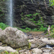
Sometimes you have to work for the reward at the end of the trail. Hiking from Craggy Gardens to Douglas Falls is a prime example. You will descend 1,350 feet from the Blue Ridge Parkway to this 70-foot waterfall through a luscious forest of birch, maple, and beech, even enjoying old growth hemlock along the way. Expect a rough hike, as the terrain is very rugged in the...
Learn More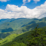
Hiking among the giants of the East. That’s what you’re doing when you take the Blue Ridge Parkway to Mt. Mitchell State Park for this trek on the Mountains to Sea Trail in the Black Mountains. With fabulous views of the Blacks and the Great Craggy Range, and closeup experiences with gnarly old growth fir and spruce krummholz, this stretch of the MtS is some...
Learn More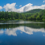
There are 84 named trails in DuPont State Forest. This robust and mature trail system is a series of arteries that connect the various and disparate sections of this family friendly recreation area. In the central region of the state forest I put together a semi-loop hike that took me first to a waterfall, then to a hilltop summit, and finally to the tranquil banks of a...
Learn More
I always enjoy hikes along the South Mills River in the Pisgah Ranger District. This loop follows the north side of the riverbank for several miles along an old logging road. But to get there, first you cross Sharpy Mountain from Turkeypen Gap. The trail travels through beautiful hardwood and heath forest as it roller-coasters across four gaps to its meeting with Wagon...
Learn More
This hike will introduce you to a good cross section of the trails found in Mt. Mitchell State Park high atop the Black Mountains in Western North Carolina. Mt. Mitchell is the highest point in the Eastern United States at 6,684′, in fact six of the 10 highest peaks are found in the Blacks. The climate of the Black Mountains is more like Canada than North Carolina....
Learn More
The Cosby area in the Smokies offers quite a few long and rugged hikes from valley floor to mountain tops, including this leg-wrecker from the Cosby Campground to the Appalachian Trail on the Snake Den Ridge Trail. Even up top there are multiple potential destinations. We chose Inadu Knob and the old search & rescue helicopter pad at Deep Creek Gap for the views...
Learn More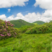
June means catawba rhododendron at Craggy Gardens. Located northeast of Asheville on the Blue Ridge Parkway, Craggy Gardens is loaded with the purple and maroon beauties. There are two short, easy trails near the Visitor Center that access mountaintops for spectacular vista views and bunches and bunches of rhodies. Craggy Pinnacle takes you above 5,800 feet for a view of...
Learn More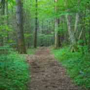
Robert “Booger” Palmer may have a silly nickname, but there’s one thing we can always appreciate him for. He never would allow loggers onto his 220 acre homestead in Cataloochee Valley. As a result, still today there is old growth forest that includes poplar trees with trunks six feet in diameter. The massive hemlocks have unfortunately succumbed to the...
Learn More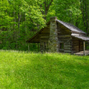
Little Cataloochee developed as an expansion to Cataloochee Valley with many of the sons and daughters of the original founders spreading their wings, albeit just a few miles away. Travel these days is limited to hiking boots and horseback, but a sense of time and place is still available through the historic restorations made by the National Park Service. Little...
Learn More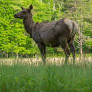
Smaller than Cades Cove on the western end of the national park, but similar in many respects, Cataloochee was named “Gadalutsi” by the Cherokee for the row upon row of mountain peaks that surround this picturesque valley. Just as Cades Cove, Cataloochee is home to many old historic structures restored by the National Park Service, as well as a wealth of...
Learn More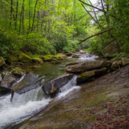
This short, little trail from Cove Creek to the State Fish Hatchery is often overlooked, but it will take you to some of the most gnarly whitewater on Davidson River. The trail is simple. It’s just a straight 1.1 mile shot from one end to the other, and then back. Ah, but have you ever seen a two-tiered trail? If you promise to be very, very careful on the river...
Learn More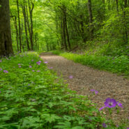
Kephart Prong is one of the many water drainages that give the Smokies its character and provide refreshing nourishment for all the flora and fauna. Named for Horace Kephart, an author who was very instrumental in helping the Great Smoky Mountains achieve national park status, this scenic mountain stream is especially inviting during the spring greening season....
Learn More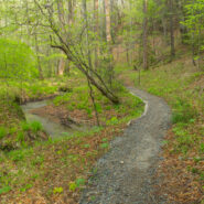
Essentially a loop trail (the two ends are about 200 yards apart on Hwy 276), Sycamore Cove is a great hike for the entire family. It’s relatively easy, with only about 600 feet of elevation change, and it’s a delightful four-season hike that is a great way to start your day. The trail initially follows picturesque Starnes Branch amidst large hemlock and...
Learn More
The U.S. Forest Service is the greatest road builder in the world. Oft times, those forest service roads come in handy for hikers to get from one ridge to another, from one creek drainage to another, or simply from one trail to another. That’s the case with Forest Road 225 in Pisgah National Forest. FR225 tips the Caney Bottom and Cove Creek Trails on its eastern...
Learn More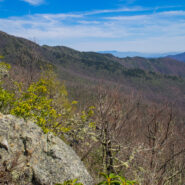
Backcountry wilderness. If you really want to get a taste, then this hike is for you. Starting at the remote Camp Daniel Boone, the northern terminus of the Art Loeb Trail enters Shining Rock Wilderness immediately. As you begin the nearly 2,000′ ascent to Deep Gap, on the southern shoulder of Cold Mountain, you will cross numerous streams as you hike through...
Learn More I am Jeff Clark, founder of Internet Brothers, producer of this blog, and passionate about hiking. I live in Western NC near the Blue Ridge and Great Smoky Mountains. Pisgah and Nantahala National Forests are just out my door, so the content will focus on these areas, but let me know what you would like to see on the site.


Copyright © 2011-2023 Internet Brothers. All Rights Reserved. ISSN 2324-6057
Designed by Elegant Themes | Powered by Wordpress | Logo by Design Aspirations