Angels Landing is a unique fin sandstone monolith that erupts 1,500 feet from the floor of Zion Canyon. The trail to the top is one of the most popular hikes in Zion National Park, certainly the most thrilling. For someone like me with heights and edges phobia and vertigo, it’s a little too much excitement, but there is a compromise. You can still enjoy most of the ascent, then join the West Rim Trail, climbing even higher than Angels Landing without the extreme drop-off business. You’ll steer clear of the crowds that line the chain to the Angels Landing summit, and have almost the same spectacular view of the incredible Zion Canyon. My brother and I hiked the Angels Landing Trail on Tuesday, October 14, 2014 beginning at 7:30AM and ending about 12:30PM. Our plan was to climb the Angels Landing Trail to Scout Lookout, admire those brave souls with the courage to continue on to the summit, then pick up the West Rim Trail for its climb above Angels Landing. The return would be via the same path.
Hike Length: 5.75 miles roundtrip Hike Duration: 5 hours
Hike Configuration: Up and back. Blaze: None needed.
Hike Rating: Difficult. Strenuous climbing. Extremely grueling and dangerous if you continue to the summit.
Elevation Gain: 1,350 to Scout Lookout. Another 250 on West Rim Trail.
Elevation Start: 4,270 feet. Trail Condition: Very good. Mostly paved pathway.
Starting Point: The Grotto shuttle stop on Zion Canyon Road.
Trail Traffic: We were on the first shuttle bus in the morning and only encountered about a dozen others on the way up, but there were a hundred or more going up as we were coming back down. Very popular trail, even mid-week.
How to Get There: Zion National Park is located just east of Springdale, Utah. You can either ride a shuttle bus into the park from Springdale, or park your own vehicle just inside the park entrance. Personal vehicles are not allowed within Zion Canyon. Be warned that the parking lot can fill quickly during prime tourist seasons (Spring and Fall). Shuttle buses run to all national park features approximately every seven minutes from 7:00AM to 9:00PM. The Angels Landing Trail is located at the Grotto shuttle stop.
I knew even before starting that I didn’t want to go all the way to the summit of Angels Landing. I’ve seen helmet cam videos of the chain on the razor thin trail with a 1,500 foot drop on both sides. No thank you! There is a compromise however. You can go about 80% of the way up to an overlook called Scout Lookout. The views are nearly as spectacular, and there is the added bonus of a connection to the West Rim Trail that goes even higher than the Angels Landing summit without the vertigo-inducing edges.
The Grotto trailhead is located across Zion Canyon Road from the shuttle stop. Simply head toward the Virgin River. Just past the trailhead sign an aluminum footbridge crosses the river and turns right toward Angels Landing. Do not get on the Kayenta Trail to the Emerald Pools.
It was almost dawn when we started. We even considered getting out the flashlights for a moment. The trail is plenty wide and easy to navigate though, so the minimal light was not a burden. We had walked perhaps 15 minutes from The Grotto toward Angels Landing when we suddenly heard a massive roar behind us as loud as a thunder clap. I thought there was a motorized vehicle bearing down on me so I jumped to the side.
Suddenly my brother pointed and had me look at the huge plume of dust that was wafting up into the canyon from very near the trailhead area. Apparently there had been a rock slab fall or landslide. It sure was loud. Later in the day we had an opportunity to ask the shuttle driver if he had heard any news about the rock fall at the Grotto this morning. He said no, but that they were an almost daily event in the canyon, so no big deal. NO BIG DEAL! What if that’s the slab you’re walking across on the way to Observation Point, or what if that overhang above you decides that today is the day?
The trail follows the Virgin River for about a half mile, then begins a fairly steep ascent through a number of switchbacks up the canyon wall to The Notch between the Angels Landing monolith and Cathedral Mountain. It’s quite a feat of engineering to put that pathway on the sandstone wall like it is. There are several stone retaining walls that help keep the trail tread in place and prevent erosion. The tread pretty much has to be paved, otherwise they would be working on it every year.

Once you reach the top of the switchbacks at The Notch you enter the remarkable Refrigerator Canyon. This slot between the sandstone walls is stunningly beautiful and contains many pine trees and scrub foliage. Judging by the amount of sand that covers the paved walkway, there is no doubt about the occasional flash flood and heavy wind gusts that rush through. It climbs gradually northward about a quarter mile until reaching one of the highlights of this trek… Walters Wiggles.
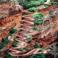
21 serpentine switchbacks steeply ascend the north face, each wiggle no more than 20-25 feet in length. The wiggles take their name from Walter Ruesh, Zion’s first superintendent, who in 1926 began constructing this trail to Angels Landing. The concrete for the job was hauled in by helicopter, taking a total of 258 flights.
Once you reach the top of Walters Wiggles you have your first close-up view of Angels Landing. A hundred yards later you reach Scout Lookout. For the first time you can peer over the east side of Zion Canyon and at the north face of Angels Landing. It’s the last chance to summon your courage before summiting. Scout Lookout is a sandy area about a half-acre in size that even has a couple of pit toilets. I can’t imagine the line that must form on a touristy summer weekend.
We paused for a few minutes to survey the remaining path to the top of Angels Landing. It didn’t take long to convince ourselves that it simply wasn’t for us. Paralysis by fear is not a healthy condition, for you, or for anyone else around you. Each person is different. Hundreds of people climb to the summit every day without incident. Hundreds of others stop at Scout Lookout. Take a look at some photos from Google Images and decide for yourself if it’s the kind of thrill you’re interested in.
The good news is, for chickens like me, that Scout Lookout is also the junction with the West Rim Trail. You can continue your hike up to the rim on a trail that isn’t hanging right on the precipice. The West Rim Trail actually continues for another dozen miles, all the way to Lava Point on the Upper Kolob Plateau. You can take it as little, or as far as you like, then return. We went up perhaps an additional three-quarters mile to a white sandstone mesa just short of The Pulpit.

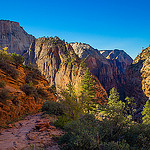
The West Rim Trail offers wonderful views of Angels Landing, the Great White Throne across the canyon, The Organ down below, Observation Point… you get the idea. There is even one spot where you can peer down into The Narrows of Zion Canyon. Pretty much everything you can see from Angels Landing, you can also see from the West Rim Trail. You get all the vistas, plus a feeling of safety and comfort.
When we were at Scout Landing there were perhaps 15-20 people milling about and another dozen on their way to the summit of Angels Landing. We were the only ones who continued up the West Rim, so we had the trail and space all to ourselves. When we returned about 75 minutes later, there were at least 50 people at Scout Lookout. Keep that in mind when deciding how to enjoy your hike. Some like the crowds and others enjoy the wilderness aspect.
The trail on the south side of Angels Landing is all red sandstone. Once you get about a half mile above Scout Lookout on the West Rim Trail it is all white sandstone. The mesa I mentioned above is a large, level area probably two acres in size that actually looks down on the summit of Angels Landing. You can see the brave people out on the edge who defeated their fears and made it. On this white mesa there is a pine grove for shade on a hot day, and it makes a great spot for panorama photography.
I remained on the mesa for probably 20 minutes, enjoying a snack and the serenity that came with the solitude. My brother went on ahead about a quarter mile just to scope out the terrain. When he returned he said there wasn’t much more of interest unless we wanted to go at least 2-3 miles farther, so we made this our point to turn around.
As we started back down, we encountered a lone solo hiker with heavy backpack no doubt heading for Lava Point, and one young trail running couple. They were the only people we saw on the West Rim Trail until we got back to Scout Lookout. From there on it was heavy trail traffic all the way back to the Grotto.
Walters Wiggles is even more interesting on the way down because you get to pass all the people on their way up. The conversations are interesting. Some have very red faces and are breathing really hard. Others are rush, rush, rushing to get to the top before their ticket expires or something. Who knows why people do what they do. My brother put together this video of the descent. Enjoy.
By the time we got back through Refrigerator Canyon and on the south side of Angels Landing the sun was now bathing Zion Canyon. Much like the day before at Observation Point, the canyon is entirely different at high noon without the extreme shadows and brightness contrast. The farther down we went, the more people were climbing up. Again, I like the idea of getting started on the first shuttle bus ride early in the morning.
Angels Landing itself was now completely alive with golden sunshine. The river was glistening, and the remaining autumn wildflowers had opened to enjoy the warmth. The temperature was at least 25 degrees warmer than when we started five hours earlier. I would say mid-October is a perfect time to visit Zion to avoid the extreme heat of the summer. Sure, the mornings can be cold, but it warms up quickly into the 50s and 60s by noon. Perfect hiking weather!

After we crossed back over the aluminum bridge to the trailhead, we found some great logs beneath a beautiful cottonwood grove along the riverbank. This was a nice opportunity to enjoy lunch, review everything we had just seen, and talk about our afternoon plans. On the way back to the Visitor Center, we got off the shuttle to walk the river at the Court of the Patriarchs. Our plans also included exploring the Kolob Terrace section of the park. When you have finished reviewing the photo gallery below, continue scrolling past the thumbnail images for more descriptive text of our adventure there.
To summarize the Angels Landing hike, it is without doubt one of the most popular and thrilling features at Zion. Know your limits, both physically and psychologically. It’s a pretty hard hike, less so if you stop at Scout Lookout. The scenery is simply stunning. It is no wonder they made this canyon a national park. The Angels Landing Trail is one you should try at least once in your life.
I really liked the option of continuing up the West Rim Trail. It made me feel a lot more comfortable with the cliff edges, yet still offered nearly the same amazing views. You can go a whole lot farther than we did. Just plan your time accordingly.
West of the town of Springdale, about half way to Hurricane is a road that takes you behind the monoliths of the West Rim of Zion Canyon. Known as Kolob Terrace Road, this paved roadway passes in and out of the national park, on BLM land, on private land, on state-owned recreation land… it runs the gamut.
This is also where some of Zion’s famous hiking trails can be found including Wildcat Canyon, The Subway, and Hop Valley to Kolob Arch. Lower Kolob Plateau runs past Tabernacle Dome, past the Red Butte Wilderness, then the road climbs through a twisty gateway to Upper Kolob Plateau with amazing fields of grassland stretching far to the back reaches of Zion Canyon.
One of the features I have always found fascinating about Zion National Park is its famous red roadways. Everywhere there is paved road within the park boundaries, it is stained red to match the Navajo sandstone that is ubiquitous to the region. The Kolob Terrace Road winds back and forth very near the confines of the park, so the road will switch from red to black, back to red, then back to black… all within a mile’s distance.
On the Upper Plateau, when you reach the La Verkin Creek Wilderness look for Lava Point Road off to the right. This 3 mile dirt road will take you to a majestic overlook of the West Rim of Zion Canyon and the Pink Cliffs far distant. Lava Point lives up to its name as there are hundreds, if not thousands, of giant black lava boulders in the area. This is also the location of the northern tralhead for the West Rim Trail, the one we were on past Scout Lookout above.
After checking out Lava Point, if you continue northward on Kolob Terrace Road you will come to Kolob Reservoir, a very popular recreation spot with the boating and fishing afficionados. It was our grand good fortune that we hit this lovely area right at peak autumn aspen color, treating us to a glittering late day display of the golden glow.
Even if you don’t hike any of the trails that are accessible from Kolob Terrace Road, you should at least take a few hours to drive from Hwy 9 to the reservoir. Particularly late in the day, with the sun low in the sky, the red sandstone buttes come alive with color and the large fields of sage and desert grass reach skyward for the last rays of the day. Enjoy the photos!
The following are paid links. As an Amazon Associate I earn from qualifying purchases.