
Essentially a loop trail (the two ends are about 200 yards apart on Hwy 276), Sycamore Cove is a great hike for the entire family. It’s relatively easy, with only about 600 feet of elevation change, and it’s a delightful four-season hike that is a great way to start your day. The trail initially follows picturesque Starnes Branch amidst large hemlock and tulip poplar trees, then climbs moderately to a ridge along Johnson Mountain. In the fall and winter, there are some nice views, including Pilot Mountain and the lush Davidson River valley below. We hiked this trail on Monday, April 28, 2014 beginning at 9:15AM and ending about 10:45AM. Our plan was to take the Sycamore Cove Loop Trail in a clockwise direction as recommended by the U.S. Forest Service.
Hike Length: 3.5 miles Hike Duration: 1.5 hours
Blaze: Blue Hike Rating: Easy. Some moderate climbing, but not strenuous.
Elevation Gain: 590 feet Hike Configuration: Loop
Trail Condition: The west side is very smooth while the east side is a little rooty.
Starting Point: Parking pullout along Hwy 276 just north of Sycamore Flats.
Trail Traffic: We encountered five other hikers in one group on this weekday.
How to Get There: From the junction of US 276/64 in Brevard, NC go approximately three quarters mile into Pisgah National Forest on 276, past Sycamore Flats. There are two parking pullouts on the left. Take either one. Both trailheads are across Hwy 276 (north side). The west trailhead is west of the two parking pullouts.
Whether you park at one of the fishing pullouts along Hwy 276 or a little further down at the Davidson River Campground, you will have to cross the road for the trailhead. So be sure to look both ways before crossing. There is quite a bit of traffic on 276, traveling 50 mph. We chose to start at the west trailhead.
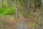
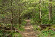
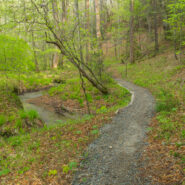
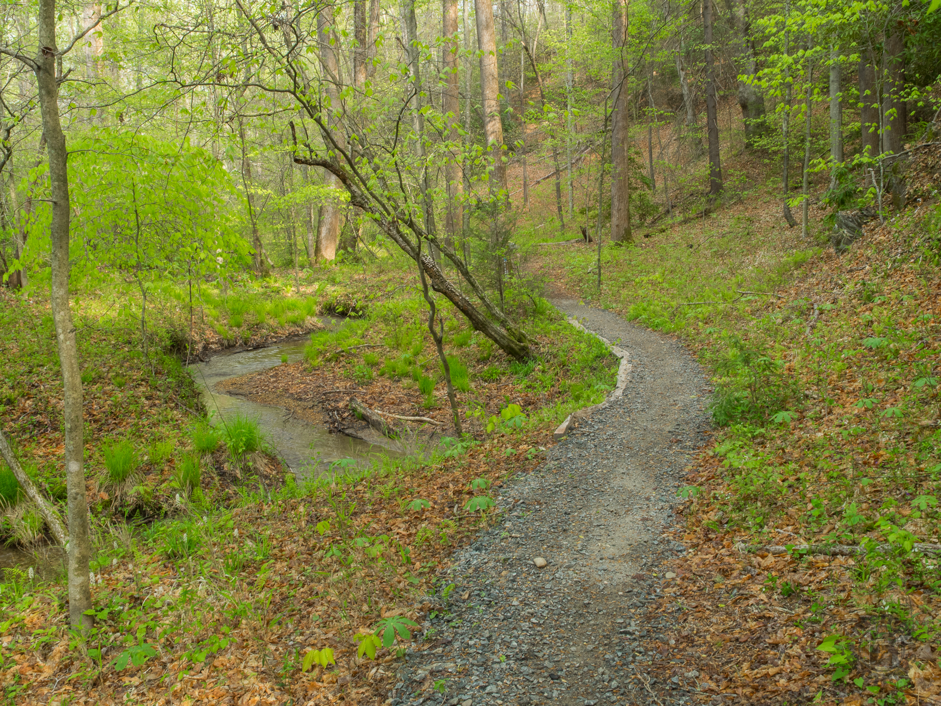
Right off the bat this trail is really scenic. It follows Starnes Branch, a little babbling brook that looks quite refreshing and appealing, especially in spring. That’s the photo at the top of this post. You may click it for a larger image. After 100 yards or so the trail dives into the forest and remains that way throughout.
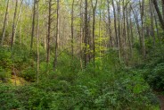
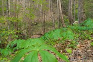
I was quite surprised at the girth of some of the poplar trees along the trail. It’s obvious it has been awhile since this area was last logged. I envy those who will live in the 22nd century and be able see these amazing giants just as the Cherokee did a couple hundred years ago.
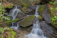
About 10-15 minutes into the hike you will pass a small waterfall on Starnes Branch on the right side of the trail. One this day in late April the forest was beginning to green nicely. I love the amazingly verdant hues that welcome the new growing season. It’s a shade of bright green you only see for a couple weeks each year.
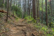
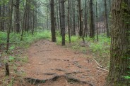
20 minutes in you will begin the climb. For the next half mile the trail goes steadily up, though not excessively steep. The trail builders have included switchbacks to ease the ascent. You will pass through a hemlock forest as the trail tread transforms to a bed of conifer needles. At one of the switchbacks you’ll reach a junction with Grassy Road Trail. That one continues to follow Starnes Branch and will eventually reattach to Sycamore Cove. It’s a means of increasing the length of this hike by about a half mile, and/or connecting with the Thrift Cove Trail deeper into the forest.
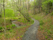
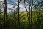
When you reach the northern junction with Grassy Road Trail you are done with climbing for the day. The next mile is nice and level as it winds ridge to ridge around the western flank of Johnson Mountain. We passed beneath rhododendron and mountain laurel canopies and occasionally were able to peer through the greening forest at the surrounding mountains off in the distance. In the midst of winter, when the trees are completely bare, there are better views. There was also a view of the Schenck Job Corps Center and the Davidson River Campground down below in the valley. Again, this view is best in winter.
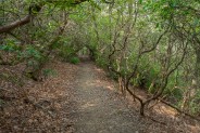
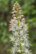
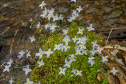
In the third mile, the trail begins the descent back to the valley floor. This east side has an even more gradual grade than the west side climb was, albeit more meandering. We crossed an unnamed stream a few times, and there were more wildflowers on this side. Plenty of bluets and violets lined the pathway, as well as mayapple and foamflower.
The last quarter mile back to Hwy 276 is a gentle stroll through bright green woodlands that is pleasing to all the senses. With remarkable aromas from the fresh growth, songbirds communicating high above, the quiet babble of the brook alongside, and the radiant colors of wildflowers and new leaves, we wished this trail was 3-4 miles longer.
It’s very easy to drive right by Sycamore Cove on your way into the more popular areas of Pisgah National Forest. I would frequently notice it on my trail map, but never give it much thought because I was usually looking for a longer hike. On this day, we were expecting rain in the afternoon, so a short morning hike is exactly what we were seeking.
The Sycamore Cove Loop Trail fills that bill nicely. Not overwhelmed with traffic because of its close proximity to the national forest entryway, it is ideal for a short, family-friendly excursion. If you’re staying at Davidson River Campground, it is basically right across the road. If you want an early-morning mountain jog before you head to work, this would be perfect. It’s a beautiful little trail. The volunteers have done a great job of keeping the track maintained in tip-top condition.
You can do this hike. Perhaps you’re still smoking, or your belly hangs over your belt a little more than you would like. Not to worry — you can still do Sycamore Cove. This is definitely on the recommend list. Get out there.

The following are paid links. As an Amazon Associate I earn from qualifying purchases.
 I am Jeff Clark, founder of Internet Brothers, producer of this blog, and passionate about hiking. I live in Western NC near the Blue Ridge and Great Smoky Mountains. Pisgah and Nantahala National Forests are just out my door, so the content will focus on these areas, but let me know what you would like to see on the site.


Copyright © 2011-2023 Internet Brothers. All Rights Reserved. ISSN 2324-6057
Designed by Elegant Themes | Powered by Wordpress | Logo by Design Aspirations


I’ve done this trial, but it was years ago. Time to go back. Thanks…
I did this trail yesterday (5/2/15). I’m so grateful I came upon your post about it. It was peaceful, beautiful… and even though it was early afternoon on a gorgeous Saturday the only people I came upon were a few mountain bikers. I have bad knees, and this trail was perfect for me. Highly recommended!
So happy it worked well for you. Keep at it!