
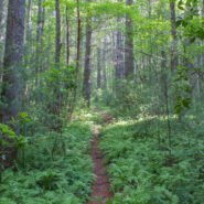
Sometimes even the most benign little trail can be filled with wondrous surprises. Nestled in a small valley between Bryson and Caney Mountains in North Mills River, North Carolina, and surrounded by Pisgah National Forest, the Foster Creek conservation easement and trail is just such a place. Barely a mile in length, and nearly flat, this four-season trail is ideal for...
Learn More
Standing guard along the state line, Max Patch Mountain is a grassy bald with fabulous panoramic views of the surrounding North Carolina and Tennessee Great Smoky Mountains. Oh, and by the way, the celebrated Appalachian Trail crosses its 4,629 foot summit. So far as Southern Appalachian summits go, this one is moderately short and easy, but you can make a day of it by...
Learn More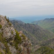
The Appalachian Trail straddles the Tennessee/North Carolina state line in Great Smoky Mountains National Park for more than 70 miles. A particularly scenic day hike on the AT is the four mile stretch from Newfound Gap to Charlies Bunion, a remote and rugged outcropping that sits on the ridge between the states. Along this sharp ridge you will pass magnificent views of...
Learn More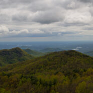
Hiking a state line offers interesting boundary markers and competing blaze markings. This hike on the Foothills Trail follows the boundary from the highest point in South Carolina — Sassafras Mountain — to a convenient end point at Gum Gap in North Carolina. Because of the length, for us this was a two vehicle hike, with one left at each end. Expect a roller...
Learn More
Back to Rough Butt Bald Overlook on the Blue Ridge Parkway, and another visit to the Mountains to Sea Trail. The MST follows, or remains close to the Parkway through much of Western North Carolina, so there are a number of easily accessible jumping off points that head into the backcountry. Middle Prong Wilderness was designated in 1984 and spans rugged high-elevation...
Learn More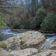
Southeast of the Cradle of Forestry National Historical Site is a remote area of Pisgah National Forest with trails that will take you along ridge lines with views of the Blue Ridge Parkway and Looking Glass Rock, then follow creeks and streams as they tumble down the mountains to the western end of South Mills River. You will encounter names like Squirrel Gap, Glady...
Learn More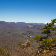
Cedar Rock is one of several granite pluton monoliths found in the Davidson River area of Pisgah National Forest. More difficult to get to than its nearby brethren, Looking Glass and John Rock, Cedar Rock has outstanding long distance views from both the east and west sides of its summit. You will have to work to get there, climbing nearly 1,700 feet from the valley...
Learn More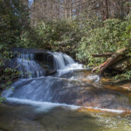
There is a series of waterfalls not far from the Pisgah Center for Wildlife Education and State Fish Hatchery on Forest Road 475. Collectively known as Cedar Rock Falls, they carry Cedar Rock Creek on its plunge down the mountain to Davidson River. Access to these falls and the wetlands beyond is via the Cat Gap Trail, a jumping off connector trail for many of the...
Learn More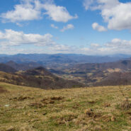
The Rough Creek Watershed is 870 acres of protected mountain land north of Canton, North Carolina, in Haywood County. This is privately held land, so there are rules for hikers and mountain bikers, but it is open to the general public. The trail system is more than 10 miles, and incorporates historical road beds with well maintained single tracks for foot and bike...
Learn More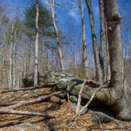
Perhaps you’re looking for a short hike that will really stretch your legs and get your heart pounding. Then you may want to consider the Pressley Cove/Maxwell Cove loop that is not too far from the Pisgah Ranger District headquarters. You’ll climb more than 1,400 feet in just a little over a mile through a beautiful poplar, oak and beech one-age forest....
Learn More
Plan a fun and safe hiking trip with a little help from this REI infographic. The illustrated map gives you a bird’s-eye view of the United States’ 11 National Scenic Trails which measure more than 18,753 miles combined. You’ll also find tips on what to bring with you hiking, as well as trail trivia. Item of interest: Only 3 of the 11 NSTs...
Learn More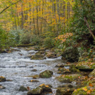
One of many trails found off Forest Road 475 in the Pisgah Ranger District near the State Fish Hatchery, Daniel Ridge Loop is a beautiful 5-miler that takes you near the headwaters of Davidson River. As you climb the ridge you’ll have views of the Looking Glass and Cedar Rock plutons on the south side, and drainage off four ridges into Davidson River on the north...
Learn More
North Mills River Recreation Area in Pisgah National Forest, along with its brother at South Mills River, has a rich and varied trail system. Among them, Fletcher Creek is a typical streamside trail that passes an old beaver pond, thick forest of hardwood and hemlock, several grassy meadows and a number of log bridge crossings over Fletcher Creek, Spencer Branch and...
Learn More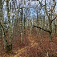
Quite frequently in winter, the Blue Ridge Parkway will be closed for snow and ice. Not great fun for those who wish to drive along the beautiful ridges. Ah — but it’s the perfect time for hikers to get out on the trails that parallel the Parkway — like the Mountains to Sea. Between Pigeon Gap and Bennett Gap at miles 412-414 the Mountains to Sea Trail...
Learn More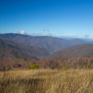
The Black Balsam area of Pisgah National Forest is surrounded by Middle Prong Wilderness on the west, and Shining Rock Wilderness on the east. Some of the best hiking found in Western North Carolina lies in this high country just north of the Blue Ridge Parkway. At the end of Black Balsam Road at milepost 420 on the Parkway, the Ivestor Gap Trail will take you deep into...
Learn More
Between mileposts 423 and 424 on the Blue Ridge Parkway, Scenic Hwy 215 crosses at Beech Gap. If you head about 1/4 mile north on 215, the famous Mountains to Sea Trail crosses from the Black Balsam area into Middle Prong Wilderness. The MtS winds through an ever-changing forest that runs the gamut of evergreens found in the high country of Western North Carolina. Past...
Learn More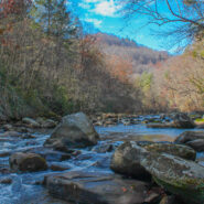
Green River Game Lands, southeast of Hendersonville, NC, sits astride the Henderson/Polk County line. Paralleling the Green River Gorge, the Game Lands is a state owned tract of more than 10,000 acres with 16 miles of hiking along nine distinct named trails. As its moniker would imply, hunting, fishing, and trapping are allowed on the Game Lands during the months of...
Learn More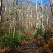
Just southeast of the Cradle of Forestry in Pisgah National Forest lies the Avery Creek area, a beautiful hardwood forest with plenty of water and a hidden pair of waterfalls known as Twin Falls. Access to the falls is via the Buckhorn Gap Trail, an easy to moderate track that first follows Avery Creek, then turns north alongside Henry Branch. The forest management work...
Learn More
Hickory Nut Gorge runs from Bearwallow Mountain in the northwest to Lake Lure southeast. Included in its 10-mile length are majestic cliffs of granite, inspiring waterfalls and scenic wilderness that beckons to the explorer in you. Chimney Rock State Park, Florence Nature Preserve and Rumbling Bald all offer excellent hiking within the gorge. Up in the northwest corner...
Learn More
Deep at the southern tip of DuPont State Forest is an area loved by mountain bikers, but also a nice place for scenic forest, riverside, and small mountain hiking. The elevation is in the 2800-3000 foot range, so it’s ideal for winter hiking where you’re not likely to get deep snow like the 6000′ peaks in the nearby national forest. Start with a lovely...
Learn More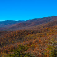
Pilot Rock is another of the granite plutons found in the Pisgah Ranger District of Pisgah National Forest. Not as spectacular as it’s more famous cousin, Looking Glass Rock, Pilot still offers remarkable views of the Blue Ridge Parkway and national forest, including the Cradle of Forestry National Historical Site. It’s a short mile climb of almost 700 feet...
Learn More
Think of Wilson Creek as Linville Gorge lite. A long, rugged wilderness gorge running from the nearly 6000′ mountain peaks at its north, Wilson Creek shares many similarities with its bigger brother to the west. Wilson Creek was named a National Wild and Scenic River in August, 2000. The gorge area is a haven for recreation including hiking of course, but also fun...
Learn More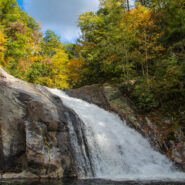
One of the highlights of the Wilson Creek Wild and Scenic River area is Harper Creek Falls. Located in the Grandfather Mountain Ranger District of Pisgah National Forest, this three-tiered falls is a fun place to swim, slide and dive — but the rugged terrain makes for a difficult and dangerous access. The Harper Creek Trail is easy enough. With the exception of a...
Learn More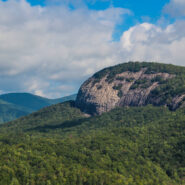
The always popular Cat Gap Loop Trail is a jumping off point for many great hikes within the Davidson River area of Pisgah National Forest. Included among them is the picturesque John Rock, one of the area’s plutons that stand over the recreation area. With views of the Fish Hatchery, Looking Glass Rock, Pilot Mountain and the ridges that run to Graveyard Fields,...
Learn More
Another of the myriad of ridge and gap trails from North Mills River to the Blue Ridge Parkway. Bad Fork Trail follows its namesake creek from Forest Road 5000 to Bent Creek Gap at mile 400 on the Parkway. This is a four mile round trip that can be extended by continuing on the Mountains to Sea Trail on the north side of the Parkway. Only moderately steep, this is a nice...
Learn More
No Food. No Map. No Cell Phone. No Problem. Imagine you found yourself alone in the desert, miles from anywhere, with no food, water, shelter or cell phone reception. Could you save your own life? Most likely, the answer is no. Left to our own devices and without supplies, the majority of us lack the necessary skills to survive. Fortunately, it’s never too late to learn....
Learn More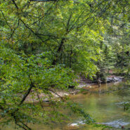
Section 1 of the Art Loeb Trail is in Pisgah National Forest near Brevard, NC overlooking the Davidson River Recreation Area. The North Slope Trail is a loop contained within the boundary created by the Art Loeb and the river. Between the two trails is a connector. Combining the two via the connector makes an 8-mile loop that takes in a large portion of the forest above...
Learn More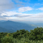
Named after the Biblical mount where Moses first saw the Promised Land, Mt. Pisgah is the landmark that gave Pisgah National Forest its name. Located on the border of Buncombe and Haywood counties in NC, close to the point where Transylvania and Henderson meet them, the mountain is easily accessible via a hiking trail from the Blue Ridge Parkway. Mt. Pisgah is topped...
Learn More I am Jeff Clark, founder of Internet Brothers, producer of this blog, and passionate about hiking. I live in Western NC near the Blue Ridge and Great Smoky Mountains. Pisgah and Nantahala National Forests are just out my door, so the content will focus on these areas, but let me know what you would like to see on the site.


Copyright © 2011-2023 Internet Brothers. All Rights Reserved. ISSN 2324-6057
Designed by Elegant Themes | Powered by Wordpress | Logo by Design Aspirations