
Hickory Nut Gorge runs from Bearwallow Mountain in the northwest to Lake Lure southeast. Included in its 10-mile length are majestic cliffs of granite, inspiring waterfalls and scenic wilderness that beckons to the explorer in you. Chimney Rock State Park, Florence Nature Preserve and Rumbling Bald all offer excellent hiking within the gorge. Up in the northwest corner is a lesser known area called Hickory Nut Forest with trails that follow Hickory Nut Creek to Cascade Falls, and then on up Little Bearwallow Mountain to a tall bluff with a precipitous slide waterfall. Bearwallow Mountain, on the eastern Continental Divide, is a short drive away with spectacular views in every direction. Make a day of hiking enjoyment by combining these two trails. This hike occurred on Friday, November 9, 2012 from 10:30am to 2:30pm. My plan was to take the Creekside Trail in Hickory Nut Forest to Cascade Falls and beyond to Little Bearwallow Falls, then drive to the Bearwallow Mountain Trail for a hike to the summit.
First Hike: Hickory Nut Forest including Cascade Falls and Little Bearwallow Falls
Hike Length: 2.2 miles Hike Duration: 2.25 hours Blaze: Yellow, blue
Hike Rating: Moderate but challenging Hike Configuration: Up and back
Elevation Gain: 820 feet
Trail Condition: Fair. Narrow single track with lots of downed trees.
Starting Point: Creekside Trailhead on Hwy 74A between Bat Cave and Gerton.
Trail Traffic: I didn’t encounter anyone else on this hike.
How to Get There: From Hendersonville, NC take Hwy 64 east to the junction with Hwy 74A at Bat Cave, turn left on 74A. Go 3.9 miles to the old chimney on the right. From Asheville, NC take Hwy 74A to Gerton. Go .9 mile east from the Gerton Community Center to the old chimney on the left.
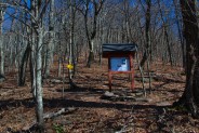
When I was looking for trail maps in Hickory Nut Gorge, I just happened upon this one in an area called Hickory Nut Forest. I’d never heard of it before, and since I was back to hiking solo for this week, I thought I’d give it a try.
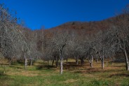
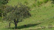
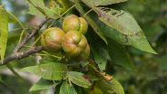
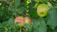
Parking for this trail is the same place as for the Florence Nature Preserve. However, the trail is on the opposite side of Hwy 74A from the parking. There is a driveway there, and a small apple orchard called Honey Bear, but no marked trailhead. It seemed odd to walk across private property, but heading through the orchard seemed the only way to get to the sounds of the creek. If anyone reading this knows how to get to the Creekside Trailhead without walking through Honey Bear Orchard, please leave a comment below.
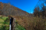
On the south side of the orchard is the well-marked Creekside Trail. Soon after, you’ll come to a split where the Creekside Trail goes left and another trail goes to the Laughing Waters eco-community. Stay left and cross a wooden footbridge over Hickory Nut Creek, then head in a westerly direction. This is a narrow trail made all the more difficult to follow because all the leaves have recently fallen from the trees. It was fortunate for me that there are frequent bright yellow blazes to mark the path through the dense forest.
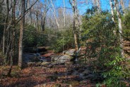
There isn’t much water in the creek this time of year, but I imagine this to be a refreshing scene in spring. There was considerable blow down across the trail, a problem that would continue to get worse the farther up the mountain I went. There were two places I had to leave the trail to go around thick branches of downed trees. A lot of this seemed fairly recent, perhaps from the heavy wind we received from superstorm Sandy, so trail maintenance will be quite the task going forward.
About a quarter mile up the trail you’ll see the Laughing Waters Retreat Center and an old grist mill on the other side of the creek. Be sure to stay on trail, as the rest is private property. Another quarter mile afterward I came to a particularly difficult downed tree that I had to go over, under and around to reach Cascade Falls. Though not particularly large, Cascade Falls is appropriately named as it has multiple tiers.
The lower cascade is reached with a bit of rock scrambling that is becoming more and more difficult as I continue to have birthdays. I just tell myself not to be in any hurry. Care and caution before excitement. I’ve taken my share of slips and falls in creeks and I much prefer to remain upright. And so I did on this day.
The upper cascade is wider with a nice pool below and a rope swing across it for doing the Tarzan thing. Obviously the eco-community folks know how to have fun. I definitely want to take a look at this area again when there is more water in the creek.
The trail onward is a touch difficult beyond the falls as there has been some erosion exacerbated by all the fallen leaves. It continues up and to the left through a rhododendron canopy. Keep your eyes peeled for the yellow blaze marks. From here on it begins to climb in earnest.
You’ll pass through a series of small switchbacks that help to moderate the ascent, then you will reach the junction with the Trail to Cliffs about a quarter mile beyond Cascade Falls. Blaze markings are now blue. There is a short dip in the trail, then the climbing begins again, now in a southerly direction.
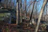
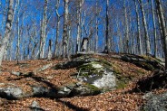
After a relatively steep climb through a forest of tall and old hardwoods you will reach a boulder field. These car-sized fallen granite boulders are moss covered and helpful as landmarks. The trail takes a sharp left turn just before the boulders. Watch for the blue trail markings. Don’t cross through the boulders.
Soon after, you’ll come to the junction with the Cliffs Trail. That’s a trail for another day, but for this hike I wanted to continue straight ahead to Little Bearwallow Falls. It’s a little confusing because both have blue blazes, but the Cliffs Trail goes west and the waterfall trail continues south.
The final 150 yards to the falls is a pretty tough scramble over rocks and fallen branches. Add to that another 75 feet or so of elevation gain and I was pretty winded when I reached the base of the falls. Especially with the fatigue, it was an anti-climax. This is a slide waterfall plunging nearly 100 feet over a sheer cliff face… but there was little to no water! Again, I just so happened to find this area for my first visit at the wrong time of the year.
I took off my pack to rest, setup the tripod for some pictures, and pulled out a sandwich for some energy. As I walked around the base of the falls looking for ideal angles for photographs, I discovered it’s pretty treacherous stepping. What little water there is tunnels its way under leaves and loose rocks making for unstable footing, as well as holes to step in and get your foot caught. Between that and downed trees, getting around was difficult. Just an advisory. Beware of the loose rock in this area. It’s very easy to turn an ankle, or worse. Please be careful.
The cliff face continues to the west. Presumably that is the path the Cliffs Trail takes. Half a mile west is a place called Wildcat Rock, and then it’s another 1/2 mile to Little Bearwallow Mountain Meadow. The Cliffs Trail then goes down the mountain and ends up back at Hwy 74A, albeit a good mile or more northwest of the old stone chimney parking.
One advantage of the leafless trees was I could see across the gorge to similar cliffs on the other side in Florence Nature Preserve. That view would not be available except in late fall and winter. So there are trade-offs. If you want water on the waterfall then you won’t be able to see the surrounding gorge.
My return to the car was uneventful. With stops for pictures and lunch, the 2.2 mile hike took just beyond two hours to complete.
2nd Hike: Bearwallow Mountain
Hike Length: 2.5 miles Hike Duration: 1.5 hours Blaze: White
Hike Rating: Moderately strenuous Hike Configuration: Loop, or up and back
Elevation Gain: 550 feet
Trail Condition: Excellent, although difficult to follow with fallen leaves.
Starting Point: Trailhead on Bearwallow Mountain Road.
Trail Traffic: I met seven other hikers on this trail.
How to Get There: From the Gerton Community Center go west on Hwy 74A about a quarter mile to Bearwallow Mountain Road and turn left. The road becomes gravel, and gets steep and washboardy. From Hwy 74A it’s 2.1 miles to the parking area on the left at a rusted gate where the road turns back to pavement.
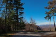
After returning to the parking area at the stone chimney, it’s a short mile drive to the Gerton Community Center and just beyond to Bearwallow Mountain Road. The road climbs through old rustic barns and farm houses, then changes to gravel for a rough but navigable track. Near the top you’ll reach the high rent district as the homes become more distinguished and the views become longer. When you again reach pavement, it’s time to park.
The Bearwallow Mountain Trailhead is just behind a rusty gate on the service road that goes to the communications towers on the top of the mountain. I like to come back down that way, but hike up the trail that was recently built by the Carolina Mountain Land Conservancy. It was kinda buried in leaves on this day, but I simply followed the white blaze markers.
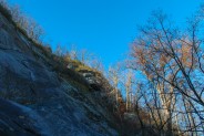
The first couple hundred yards are the steepest part of the trek, so it’s nice to get that out of the way early. I found that as I got higher, the trail was less leaf covered making it easier to follow. One of the interesting things about this hike is the ledges you can see in the granite as you make switchback turns back and forth. I’ve been here in the dead of winter when the granite ledges are covered in ice — making it very attractive — but also making the trail very treacherous. The CMLC trail builders did a nice job of creating stairways out of stone and log to make these ledges easier to navigate.
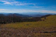
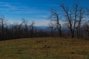
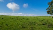
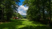
As you continue to climb, the view is mainly to the east, and to the Black Mountains far in the distance to the north. After a mile of climbing, the trail pops out on the very long double summit. To your right will be the western bald pasture, and to your left will be the top of the mountain with all its communications and fire towers. The mountain sits atop the eastern Continental Divide and makes the northwestern rim of Hickory Nut Gorge.
On this day I headed first across the pasture to the southern side for a look at King’s Mountain and on toward the South Carolina Upstate. Below is the town of Hendersonville. Walking then toward the western end of the pasture, you can see the imposing Mt. Pisgah far in the distance with the massive TV tower on its summit. Watch out for the cow pies on the grassy top as this is still an active pasture during certain times of the year.
The longest views are from this western end as you can see the ranges of the high country more than 40 miles away. Some of the peaks in the Great Balsams are over 6000 feet. Although I haven’t yet been there at sunset, this particular spot is a haven for photographers at dusk as it offers clear views of the western sun setting over those awesome mountains.
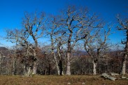
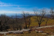
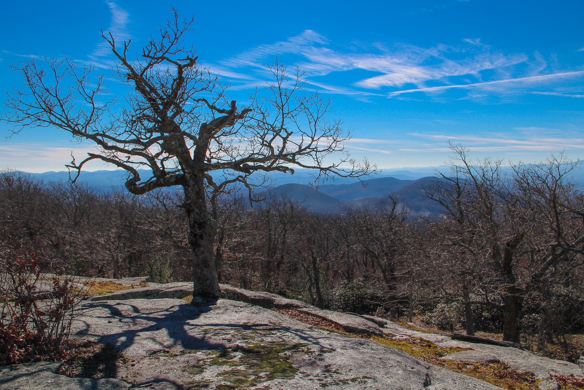
Crossing the pasture back to the east, I reached the service road for the final climb to the summit. It’s about another quarter mile on this gradual grade of perhaps another 100 feet. In addition to a farm of communications towers and an old fire tower, the summit is capped with large granite outcroppings and the wonderful gnarly, twisted trees like you see in the photo at the top of this post. Click it for a larger image.
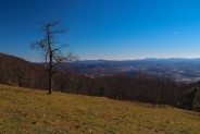
This side gives you the best view to the east, and down Hickory Nut Gorge. The southeastern side is tree covered, so you can’t really see as far as Lake Lure — at least I haven’t been able to find it. From this summit you can also see the stunning Black Mountains away to the north, another range of 6000 foot peaks including Mt. Mitchell, the tallest mountain east of the Mississippi. Asheville is to the northwest.
As I mentioned above, I like to make the return trip on the service road because it’s a nice winding stroll through the woods. As it departs the summit it heads directly north so you have a great view of the Black Mountains straight ahead for the first quarter mile or so. The service road turns this circuit into a loop.
When you get back to Bearwallow Mountain Road, if you continue westerly in your vehicle you will come to Grand Highlands on Bearwallow Mountain, a lovely community of high country horse farms and high-end residential property. I come up here frequently very early in the morning to catch the post dawn sun rays as they shine on the Blue Ridge far in the distance.
In summary, Hickory Nut Forest and Bearwallow Mountain are a nice way to combine two short hikes and make a day of it. It seems to me that spring is probably the best time to check out Cascade and Little Bearwallow Falls. The water will be rushing over the waterfalls and down Hickory Nut Creek. and the wildflowers will be smiling in the forest. Bearwallow Mountain offers remarkable views no matter the season and is one that I do quite frequently.


Update September 4, 2016: Made another visit to Bearwallow Mountain. I like the short hike to the summit. It’s near my home so I can go see it on a whim. Trees that surround the summit have grown quite a bit in the four years since my initial post here. Many of the views are now obscured, including the best view of Mt. Pisgah. Perhaps winter trips will be called for in the future. Here is another photo gallery. Feel free to leave your comments below the gallery.


The following are paid links. As an Amazon Associate I earn from qualifying purchases.
 I am Jeff Clark, founder of Internet Brothers, producer of this blog, and passionate about hiking. I live in Western NC near the Blue Ridge and Great Smoky Mountains. Pisgah and Nantahala National Forests are just out my door, so the content will focus on these areas, but let me know what you would like to see on the site.


Copyright © 2011-2023 Internet Brothers. All Rights Reserved. ISSN 2324-6057
Designed by Elegant Themes | Powered by Wordpress | Logo by Design Aspirations


