The far southwestern corner of DuPont State Forest offers a forested hike atop multiple plutons, past a retired rock quarry, and across a couple of gentle mountain streams. The oak trees are in abundance, as are white and longleaf pines. Look for the fascinating moss and reindeer lichen on the plutons as you gaze at the far away mountains of Pisgah National Forest. This section of the state forest is quite popular with mountain bikers, but hikers can enjoy the scenery every bit as much. Ken and I explored the Micajah on Wednesday, December 16, 2015 from 10:30AM to 2:15PM. Our plan was to take Wilkie Trail to Micajah Trail, then Buck Ridge Road to Buckhorn Creek Road and its meeting with Cannon Creek Trail. We would end the outward trek at Rich Mountain Road, then return back to Buck Ridge. From there we would take Rock Quarry Road to the northern half of Micajah Trail and back to Wilkie.
Hike Length: 8 miles Hike Duration: 3.75 hours
Hike Configuration: Out and back Blaze: None needed
Hike Rating: Moderate, because of length and some modest climbing.
Elevation Change: 350 feet, 755 feet gain Elevation Start: 2,720 feet
Trail Condition: Very good. All but the Cannon Creek Trail is wide and appropriate for mountain biking. There is some slick granite on the plutons.
Starting Point: Corn Mill Shoals parking on Cascade Lake Road.
Trail Traffic: We encountered two other hikers and a half dozen mountain bikers.
How to Get There: DuPont State Forest can be accessed from Hendersonville, NC via Kanuga/Crab Creek Rd., from Asheville/Brevard via US64 and Little River Rd., or from Greenville, SC via Cedar Mountain and Cascade Lake Rd. Corn Mill Shoals parking is in the southwest corner of the forest. Look for printed trail maps at public parking areas.
Once parked at Corn Mill Shoals, walk south along Cascade Lake Road about 50 yards to the Wilkie trailhead. Unlike nearly every other trail in DuPont State Forest, there is no sign to mark this one, but look for three boulders along the woods’ edge and a pathway leading west. You immediately cross the power line right-of-way and then plunge into the mixed oak and pine forest.
Hikers share all the trails along this route with mountain bike riders, or vice-versa, so be on alert for bikes approaching or coming up behind you. The Wilkie Trail is single track, so you will need to step aside to make room for the bicycles.
Wilkie Trail climbs gently, winding its way up the massive granite slabs known as plutons. Eons ago, when the Earth was in various states of upheaval, igneous rock (called plutonic rock) crystallized from magma slowly cooling, and erupted above the surface to form these rounded mountaintops that are so common in the mountains of Western North Carolina.
The moist granite is home to diverse species of moss and lichens that cover the surface in a carpet-like fashion. It takes hundreds of years for these lichen beds to form, so do your best to avoid walking on them so they will be preserved for the future. The thick moss holds moisture for days, even weeks, after the latest rainfall leaving the granite surfaces perpetually wet and slick. So make sure your steps are planted firmly, especially going downhill, to avoid a nasty slip and fall.

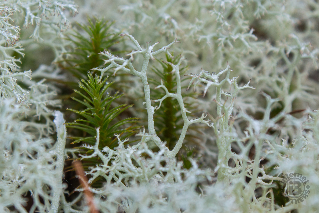
Reindeer lichen is light mint in color, growing in open environments like the plutons of WNC. It is primarily found in alpine tundra, and is grazed by caribou, hence the name. Reindeer lichen is slow growing, and may take decades to return once grazed, burned, or trampled. Click, and look closely at the water droplets on the intricate branches.
Soon after crossing what I would describe as a “granite meadow” (a granite area open to the sun in the midst of the forest), you will reach the junction with the Micajah Trail. Urban Dictionary defines Micajah as a white male with blonde hair and blue eyes who has so much swag he is like the hottest guy ever. I suspect, though, that when this trail was named, the designators where thinking more in terms of the Biblical name derived from Michael. Ken and I had fun with the pronunciation, each of us coming up with multiple options. Call it what you will, it’s a very nice trail.
Micajah Trail goes either left (south) or right (north). Either direction will get you to the eventual destination of this hike. We chose to go left — simply because we could. Not long after, you cross another pluton, this one with the grandest view of the surrounding mountains. It’s a great place to have a seat on the exposed granite and catch a few sun rays, or grab a snack before resuming the trek.
The Micajah Trail isn’t particularly long, totaling just a mile, and split about equidistant from the Wilkie junction. On the south half, it ends at Buck Ridge Road which turns essentially due north. Now you are on wide double track for the next 0.6 mile. This is where we saw the only other hikers, as well as a trio of mountain bikers.
On the north end is another road junction, this one with Buckhorn Creek Road on the left and Rock Quarry Road on the right. We would be back to this point later to take the road to the quarry, but for now we turned south on Buckhorn Creek. There is a modest descent for the first quarter mile, before reaching and crossing Buckhorn Creek.
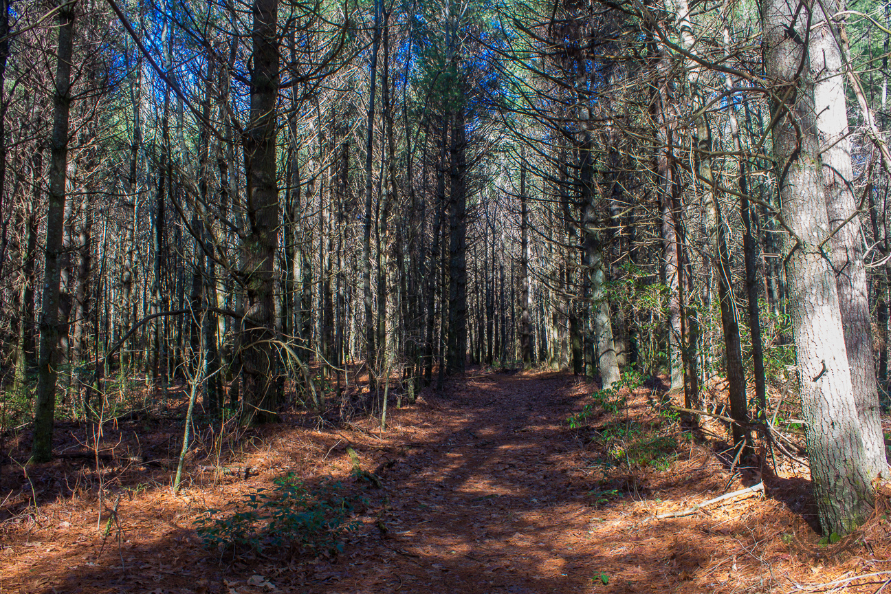
The forest along all these trails is noticeably dense. It’s obvious this whole area was logged at one time, but the recovery growth consists of mid-age trees and saplings, and tons of them. With the recent completion of the November leaf fall, the pathways are strewn with both oak leaves and pine straw. With considerable recent rain, they were mostly damp, creating an extremely nice and cushioned trail bed. It’s almost like wearing little springs on your hiking boots.
After three-quarters mile on Buckhorn Creek Road, we reached Cannon Creek Trail, turning right (north). This trail, for its full length, pretty much skirts the state forest boundary. So we heard many sounds coming from private property, including the howl of the hounds still treeing prey for their hunter masters.
For the next mile, the forest changes as quickly as the direction of the wind. First you’re in a plantation of tall white pines, followed by more of the dense oaks, then finally mountain laurel country. The laurel is quite healthy and I suspect it puts on quite the floral display in June, rivaling the best the nearby national forest has to offer.

Like many areas of Georgia and South Carolina, you can find these large pine plantations in DuPont State Forest.
Looking at the DuPont State Forest trail map before embarking on this hike, I was hoping the Cannon Creek Trail would follow along the creek offering points of access, even areas along the bank appropriate for water photography. That wasn’t to be the case, however, as the trail stays a good 50 feet above the creek drainage for the duration. Between the trail and the waterway is rhododendron and dog hobble thick as Brillo.
There is one crossing of the crystal-clear water of Cannon Creek, otherwise you have to content yourself with the soothing sound of the moving water just beyond reach. Very near the trail terminus at Rich Mountain Road is an obvious waterfall. You can certainly hear the tell-tale sound of a cascade. At a few points along the trail, you can even see portions of it through the impenetrable thicket of rhodos. A bushwhack wasn’t on our minds this day. Too bad. It looks to be at least 25 feet tall. We found a nice outcrop on a hill above the trail offering a comfortable place to enjoy our lunch.
We returned the way we came, until reaching the three-way junction, this time continuing on Rock Quarry Road to make a loop with the north end of the Micajah Trail. As you would imagine by its name, this road passes the remains of a retired rock quarry, the tailings strewn all about on either side of the road. It isn’t particularly attractive, but is yet another example of the varied history of this region before it became DuPont State Forest.
After passing through another “granite meadow,” after a half mile Rock Quarry Road re-enters the forest at the northern junction with the Micajah Trail. We turned right here, then a few hundred yards later crossed Tom Creek and returned to the junction with Wilkie Trail. The downhill off the plutons is a little more tense, due strictly to the wet and slippery granite under foot. We finished this 8-mile semi-loop less than four hours after starting, a pretty good pace.
To summarize, I thoroughly enjoyed this combination of trails in the southwestern corner of DuPont. It is quite scenic, with rich woodland and picturesque vistas throughout its length. Not particularly difficult, these trails would work well during any season, and for nearly any family member. Look for wildflowers in Spring, and excellent Fall color from the myriad of oak trees. Keep in mind that there are also bicycles on the trail so you don’t have a surprise meeting. Also, unlike many of the more popular areas within DuPont, you won’t have to battle with crowds here.
The following are paid links. As an Amazon Associate I earn from qualifying purchases.