
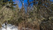
The Appalachian Trail splits the states of North Carolina and Tennessee through most of the breadth of Great Smoky Mountains National Park. Hugging the state line as it traverses the rugged and remote ridges, the AT is a favorite destination for day hikers and thru hikers alike. There is a three and a half mile stretch from Newfound Gap to the summit of Mt. Kephart, and beyond to a magnificent overlook known simply as The Jumpoff, that provides an excellent example of what high country Smoky Mountains terrain is all about.
I’ve written a trail report for this hike and the eventual destination of Charlies Bunion from a previous occasion. Here, I merely wanted to share some new photographs from a recent winter visit to this picturesque mountain backcountry.
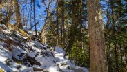
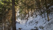
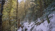
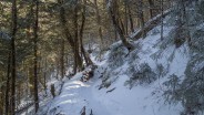
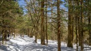
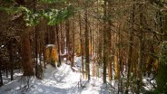
My friend Dave and I climbed the nearly 1,200 feet from Newfound Gap to Mt. Kephart’s summit on Sunday, February 28, 2016. Only a couple days had passed since the last snowfall. The 3-4″ ground cover was packed down from the boots of many hikers who had made the same trek in the preceding days. Ice traction on the feet was the order of the day.
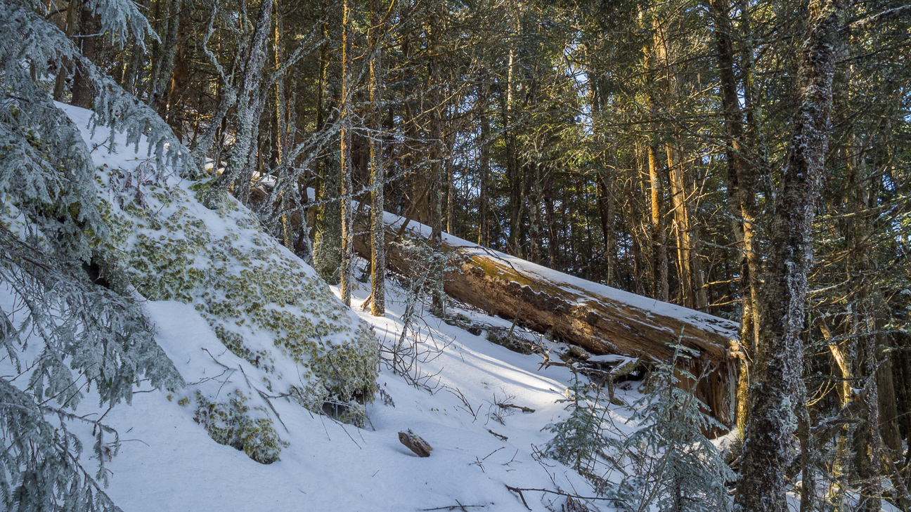
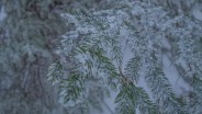
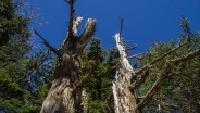
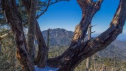
The mixed spruce and fir krummholz forest with a fresh coating of snow. This poor tree succumbed to the constant beating of winter storms at 6,000 feet in the Great Smoky Mountains.
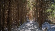
At the 3-mile mark the Appalachian Trail meets the Boulevard Trail. To get to Mt. Kephart and The Jumpoff you need to turn left onto the Boulevard, and then almost immediately take a right on The Jumpoff Trail. It’s then a pretty strenuous climb of a couple hundred feet to the summit of Mt. Kephart, named for a famous author who was quite instrumental in the creation of the Smokies national park.
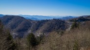
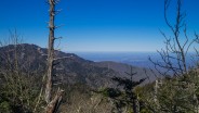
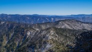
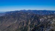
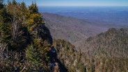
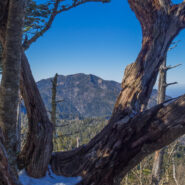
From the summit there is an absolutely breathtaking view of the massive shoulders of Mt. LeConte off to the west. On this particular day, the sky was cloudless, perhaps the most crystal clear viewing of LeConte I have seen in several visits to this spot. Just a few hundred yards more down the other side of the summit leads to the perilous overlook called The Jumpoff.
From there, you are peering down into the Lester Prong basin, following the Appalachian Trail on its journey east past the craggy outcroppings of Charlies Bunion and onward toward Mt. Guyot. On the north side of The Jumpoff is a view of the rock face known as The Gorilla, and the ridge below called Horseshoe Lead. Far in the distance is the Tennessee community of Sevierville. Directly below is Masa Knob, named for the faithful photographer George Masa who was Horace Kephart’s constant companion.
I hope you enjoy these new photos from this visit to the high country along the Appalachian Trail as much as we enjoyed the day. Please feel free to leave your comments below the gallery.


The following are paid links. As an Amazon Associate I earn from qualifying purchases.
 I am Jeff Clark, founder of Internet Brothers, producer of this blog, and passionate about hiking. I live in Western NC near the Blue Ridge and Great Smoky Mountains. Pisgah and Nantahala National Forests are just out my door, so the content will focus on these areas, but let me know what you would like to see on the site.


Copyright © 2011-2023 Internet Brothers. All Rights Reserved. ISSN 2324-6057
Designed by Elegant Themes | Powered by Wordpress | Logo by Design Aspirations
I needed a mental hike this morning! Thanks much.
Good timing then. Glad I could help.
Hey Jeff! Thanks for another awesome post! My family and I did this hike last year around the middle of March. There was quite a bit of black ice that day, but it was wonderful! In the Mt. Guyot picture, can you tell me which peak is Mt. Guyot? I’m thinking it is the prominent peak left of the dip in the center of the photo, with Old Black the lower peak to the immediate left. Maybe the peak to the right of Guyot is Mt. Chapman or Tricorner Knob.
Hey Jon. Mt. Guyot is the tallest peak in the far distance just left of center.
That’s what I was thinking! I did it last fall from Cosby Campground. It was an awesome day! My first bushwhack.