Thompson Creek Trail climbs Thompson Ridge from Forest Road 1206 to a point just below the Pisgah Inn on the Blue Ridge Parkway. To the southwest it overlooks the Cradle of Forestry National Historic Site and the Pink Beds. To the east it crosses from Transylvania County into Henderson County and joins the Pilot Rock Trail along the Slate Rock Ridge for the descent across Pilot Rock, and back to the forest road. Along the way is multi-terrain hiking, varying from a creek-side stroll, to switchbacks on all fours, and rocky scrambles across a granite pluton. Make sure you’re in good physical condition for this one. This hike occurred on Thursday, January 5, 2012 from 10:40am to 2:25pm. The plan was to climb Thompson Ridge by taking the Thompson Creek Trail to the Pilot Rock Trail, then descend, with stops along the way for lunch and pictures from Pilot Rock.
Hike Length: 6.7 miles Hike Duration: 3.75 hours
Hike Rating: Difficult, strenuous Blaze: Blue, orange
Elevation Gain: 1750 feet Hike Configuration: Loop, up then back down
Trail Condition: Excellent on Thompson Creek, rocky on Pilot Rock. Watch for ice in winter.
Starting Point: Trailhead is on the left 3.5 miles in on Forest Road 1206.
Trail Traffic: We encountered one other hiker on Pilot Rock Trail.
How to Get There: From the Brevard, NC junction of Hwys 64/276 take US 276 into Pisgah National Forest 11 miles. Turn right on Forest Road 1206, drive approximately 3.5 miles, trailhead located on left with minimal parking on the right.
View Thompson Creek and Pilot Rock Loop, Pisgah National Forest in a larger map
The trailhead is kinda hard to find. It’s roughly 3.5 miles in from Hwy 276. The marker is on the left, up four steps off Forest Road 1206 in the woods. It is especially difficult to see in summer when the foliage is in full array. Just keep your eyes peeled. There is room for 2-3 cars on the right side of the road. Look for that as well.
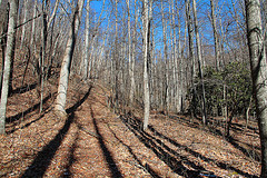
The blue-blazed Thompson Creek Trail starts out innocent enough. It’s a nice stroll through a beautiful forest with oak, hickory, maple and other hardwoods that are common to Pisgah National Forest. The trail itself is wide and well maintained. The first indication things are about to change occurs 3/4 mile in when you reach the Thompson Creek crossing. It’s about 10 feet wide with rocks to step across, however it can be treacherous if the water is up as it was on this day. The moss covered rocks become quite slippery. I was looking upstream for an easier crossing when my companions, already on the other side, tossed me a trekking pole and said go for it. Be careful.
On the northern side of the creek the trail immediately begins its relentless uphill haul. Steeper and steeper it climbs, eventually leaving the creek-side behind. I recommend pausing every few hundred yards for a 30 second breather because it keeps getting steeper the higher you get. The air gets thinner too. I determined that by the tell-tale fire inside my lungs. Until about the last 4/10 mile, it is a straight shot up Thompson Ridge — no switchbacks to ease the pitch. In winter you can see through the forest to the ridge ahead, not quite a demoralizing deterrent, but the top seems to be always farther up.
Then finally, the forest begins to change from hardwood to evergreen, heath and laurel. This is the signal that the switchbacks have arrived. The final .4 mile is the steepest, sometimes requiring hands on the ground ahead of you for stability. I lost count, but there are close to 20 switchbacks, each gaining 30-50 feet in elevation. We were fortunate on this winter day to be in a minimal amount of snow as we were on the south exposed side of the ridge. It’s not a bad idea to carry some kind of ice cleat with you when hiking this trail in winter. I use Stabilicers®. With near 5000 feet elevation and the steepness of the terrain, icy conditions would make this an extreme slipping hazard.
 At the end of the switchbacks the trail pops out on top of Thompson Ridge and offers views of the surrounding mountains. To the north is the Blue Ridge Parkway and Pisgah Inn. Westward are seemingly endless ridges. The clear winter air enables you to see for miles and miles from one ridge to the next. Below and to the south is the Pilot Rock pluton, one of the destinations on the downward trek. The trail turns in an easterly direction at this point as it crosses from Thompson Ridge to Slate Rock Ridge.
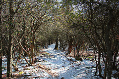
The trail also narrows. It is more or less hanging on the side of the mountain with the Bradley Creek drainage down below. The foliage is nearly all mountain laurel now, gnarly and distorted from the harsh winters, yet quite hearty. The trail had more snow. Not as much sun was reaching it here. There’s one final short push upward and then you meet the Pilot Rock Trail where the blaze markings change to orange.
Just past the junction we happened upon the only other hiker we saw this day. He was coming up the trail we were about to go down. We introduced ourselves, told him we were Meanderthals and had come up Thompson Creek. He just shook his head and raised his eyebrows, affirming the Meanderthals part. This makes the third time we have done this hike. The first time we started up top at the Buck Springs Gap Overlook on the parkway, went down Pilot Rock and then came back up Thompson Ridge at the end. It was an ego killer. So the next two times we have started from the bottom to get the climb out of the way first. This is my recommended way to do this hike.
Along Slate Rock Ridge the mountain laurel forms a beautiful canopy that goes for 1/4 mile. With snow beneath, it made for an artistic scene. Every time I come to this ridge I say I want to be here during the laurel bloom season. Perhaps I will remember this coming spring.
 The Pilot Rock side of this loop is extremely craggy and rocky. Unlike Thompson Creek, this is also a mountain bike trail. The trail is more rutted, with exposed roots and loose stones, all hazards just waiting for a misstep. There are switchbacks here too as the descent is nearly as steep. About 30 minutes down from the top is a large, flat granite outcrop that is a perfect spot for lunch. There is a fabulous view of the Blue Ridge Mountains to the west. The outcrop is covered with a smooth moss/lichen mixture that is almost like carpet.
Refreshed and re-energized after lunch and conversation, we continued our descent to Pilot Rock. A pluton is a body of igneous rock formed beneath the surface of the earth by consolidation of magma. During times of geologic upheaval the massive rock domes will be exposed above the surface. There are a dozen or more plutons in Pisgah National Forest, all fascinating, and all worth exploring. The rock climbers love them as well. Pilot Rock is no different. I was happy to see it wasn’t wet or snow covered because the granite face is very steep.
Pilot Rock is an ideal photo spot. To the west you can see Fryingpan Mountain with its old fire tower. To the east is Slate Rock and Pilot Cove. The vast expanse of the Cradle of Forestry is below to the southwest.
As the trail winds down below Pilot Rock, the forest changes again to hardwood and is littered with very large boulders that I assume to be glacial breakdown. The trail climbs in, among, around and over them. Eventually the trail goes beneath Pilot Rock with a view back up through the trees of the high and long cliff face. The forest here is thousands of tall, thin saplings. I’m anxious to learn the story of what happened here before, and why the forest is so young. Perhaps it was logged. Perhaps there was a completely destructive fire. I need to speak with my totally informative National Forest Service ranger.
The final 1/4 mile of Pilot Rock Trail is alongside Bradley Creek, a creek that seemingly winds all throughout the Pisgah Ranger District. We weren’t quite done though. When you get to the end of the Pilot Creek Trail it spills onto Yellow Gap Road about a mile east of the Thompson Creek trailhead where our car was. For the first couple hundred yards the road climbs, but then flattens out for most of the slog back to the beginning. I know from experience this stretch of forest service road is brilliant in autumn. The colors are magnificent. Be sure to check it out.
This loop is great exercise. It’s a strenuous 3-4 hour hike that is accessible in all seasons. My hiking buddies like it better than I do, but I can see the appeal. There is beautiful forest, creek-side trails, vigorous climbing, mountain vistas, granite escarpments, and thick laurel vegetation. What’s not to like?
The following are paid links. As an Amazon Associate I earn from qualifying purchases.
Hi Jeff – I just wanted to say thanks. I was unable to find any decent info on trails in the Pink Bed area and I had never been to Pisgah so I didn’t know what to expect. Your journal outlined all the details for this trail loop and helped me pick an awesome campground this past weekend.
Thanks to you, me and my friends had an outstanding weekend in Pisgah. Now that I’m familiar with the area, we will be back many more times!
That’s great! I’m glad it worked out for you.