
Leaving civilization behind, hikers on the North Country Trail come for the beauty, the views, the solitude and the forests. “It’s the longest, skinniest National Park in the nation being four feet wide and 4,600 miles long, and people from all across the nation come and they especially come to the western U.P. [Michigan] in general to see our trees,” said Connie Julien,...
Learn MoreMichigan’s Iron Belle Trail is the longest state-designated trail in the nation, encompassing more than 2,000 miles of hiking and biking routes, allowing users to explore pristine forests and cool rivers while connecting big cities to smaller and diverse towns. The trail extends from Belle Isle in Detroit to Ironwood in Michigan’s western Upper Peninsula. It is slated to...
Learn MoreThe experience many hikers, bicyclists and afternoon strollers seek is simply being on the trail and enjoying their companions and surroundings. There are plenty of others, though, whose time on the trail is best topped off with a special reward—a unique experience, a breathtaking view, an intriguing discovery and Michigan trails can provide that. Nationally known as...
Learn MoreA myriad of Michigan hiking trails offer at least one of the following — eye-popping Great Lakes beach views, scenic overlooks that stretch for miles, picturesque rumbling creeks, powerfully flowing rivers, a canopy of majestic hardwoods, a peaceful thicket of pines or wide array of wildlife. Come autumn, of course, the state’s pathways add their finest feature,...
Learn MoreTahquamenon Falls State Park is celebrating Michigan Trails Week with its annual 5-mile hike Sept. 24, 2016 along the Tahquamenon River, between the Upper and Lower Tahquamenon Falls in Luce and Chippewa counties. “This spectacular hike is a very popular event at Tahquamenon Falls State Park,” said Theresa Neal, park interpreter. “It allows us to showcase not only the...
Learn More
Beavers aren’t just busy — they’re swamped. But while building and maintaining a marsh can take time, it’s apparently worth the investment. The rodents’ ecosystem-shaping homes have long been known for their durability, and a recent study offers unique evidence that individual beaver dams can persist for centuries. That evidence comes via an 1868...
Learn MoreWithin the deep emerald twilight of the north woods, as the smell of pine and moss gives way to the lake-crisp air and the windblown expanse of Lake Superior washing up against the sandstone cliffs and rocky beaches, it’s easy to forget all of the stresses of civilization. On the North Country Trail — the longest and one of the wildest trails in the U.S. — you can....
Learn More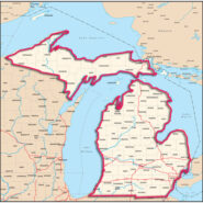
Michigan’s recreational trails offer jaw-dropping glimpses of the Great Lakes stretching out against the horizon. They feature cliffs that look like they were squirted with giant tubes of fingerpaint. And miles of soft sand to trudge ‒ a scenic way to tighten the glutes. Wander off the public parks and more breath-taking vistas await (as well as the occasional...
Learn MoreA new hiking and bicycling trail stretching hundreds of miles through Michigan will officially be called Michigan’s Iron Belle Trail, officials have announced. The trail will run from Belle Isle Park in Detroit to Ironwood in the western Upper Peninsula along the border with Wisconsin. Michigan Department of Natural Resources Director Keith Creagh said in a...
Learn MoreNewly released US Topo maps for Michigan now feature segments of the North Country National Scenic Trail. Several of the 1,290 new US Topo quadrangles for the state now display parts of the Trail along with other improved data layers. “USGS maps are excellent planning and navigation tools for hikers and other trail users” said Mark Weaver, Superintendent of the...
Learn More I am Jeff Clark, founder of Internet Brothers, producer of this blog, and passionate about hiking. I live in Western NC near the Blue Ridge and Great Smoky Mountains. Pisgah and Nantahala National Forests are just out my door, so the content will focus on these areas, but let me know what you would like to see on the site.


Copyright © 2011-2023 Internet Brothers. All Rights Reserved. ISSN 2324-6057
Designed by Elegant Themes | Powered by Wordpress | Logo by Design Aspirations