
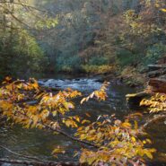
Looking for a hike that includes streams and rivers, hardwood and conifer forests, plentiful rhododendron, and some climbing for good measure? Then the trails along South Mills River that embark from the Turkeypen Trailhead may be just the ticket. Situated in the southeastern corner of Pisgah National Forest, the Mills River Area is the largest in the Pisgah Ranger...
Learn More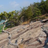
Perhaps the most popular hike in the Pisgah Ranger District of Pisgah National Forest, the Looking Glass Rock Trail is a good 3-mile leg stretcher to the top of the famous pluton. Probably not the most scenic hike is the area, but definitely popular because of ease of access, and a little less difficulty than some of the steeper monoliths. Looking Glass Rock is home to...
Learn More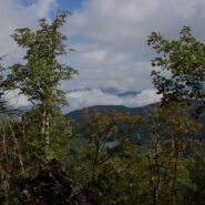
Kind of an unusual name for the mountain this trail is named after, but it is at 5,200 feet, so the snow comes earlier in the season, and more frequently than in the valleys below. North of Asheville, NC on the Blue Ridge Parkway, this hike is in the Craggy Gardens area. There are splendid views of the Great Craggy Mountains and the Black Mountains from the three summits...
Learn More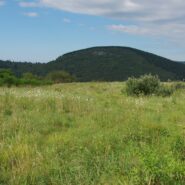
Flat Laurel Creek is in the area just north of the Pisgah Ridge and in between the Shining Rock and Middle Prong Wildernesses. It drains from Sam Knob and Little Sam Knob and runs to the West Fork of the Pigeon River. The trail that bears its name starts at the headwater and travels 3.7 miles around the west side of Little Sam until it meets Hwy. 215 and joins the...
Learn More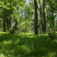
Looking at a trail map or topographic map, the area of this hike within Shining Rock Wilderness can be somewhat confusing. There is the Greasy Cove Prong, a creek that runs off of the Grassy Cove Ridge. The trail is called Greasy Cove, but it starts/ends at Grassy Cove Top. I think the guys who named the area may have had a touch too much huckleberry wine. Regardless of...
Learn More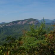
Coontree is a popular picnic area for familes along Davidson River in Pisgah National Forest, NC. What most of them probably don’t know though, is that there is a nice hiking trail just across Hwy. 276 from the parking area. It is very easy to get to, as it is only five miles from the crossroads in Brevard, NC. The trail itself is a loop with a connector at the top...
Learn More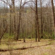
Hidden deep within the Mills River area of Pisgah National Forest, the Pilot Cove/Slate Rock Creek loop trail is primarily a water feature hike. There are two notable waterfalls and several cascades on Slate Rock Creek, and views of Slate Rock through the trees. We encountered several creek crossings (some wading, some with log bridges), and a relatively young forest....
Learn More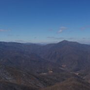
Between North Carolina Scenic Hwy. 276 and the Pisgah Inn is Fryingpan Mountain, one of a series of mountains along the north side of the Blue Ridge Parkway that help form the Pisgah Ridge. It sits at mile 410 on the parkway. A unique feature of Fryingpan is the 1940s era fire tower that affords spectacular views of the surrounding Blue Ridge. The tower is on the...
Learn More
This hike is in one of my favorite areas of Pisgah National Forest along the Blue Ridge Parkway in western North Carolina. It lies in a little corner between Middle Prong Wilderness and Shining Rock Wilderness where the mountain tops are bald and exceed 6000′. This hike occurred on March 24, 2011 beginning at 10:00AM and ending about 3:00PM. The goal on this day...
Learn More I am Jeff Clark, founder of Internet Brothers, producer of this blog, and passionate about hiking. I live in Western NC near the Blue Ridge and Great Smoky Mountains. Pisgah and Nantahala National Forests are just out my door, so the content will focus on these areas, but let me know what you would like to see on the site.


Copyright © 2011-2023 Internet Brothers. All Rights Reserved. ISSN 2324-6057
Designed by Elegant Themes | Powered by Wordpress | Logo by Design Aspirations