
Water. Forest. Mountains. History. For me, that is what Great Smoky Mountains National Park is all about. On the Smokemont Loop hike you will get all of them. For the first couple miles, stroll along one of those beautiful mountain streams the Smokies are known for, then prepare your legs and lungs for a tough climb 1,350 feet through the forest to the top of the ridge. In seasons when the leaves are down you’ll be able to view Newfound Gap far to the north. As you descend back to the campground you will pass an old homestead and Bradley Cemetery, reminders of what the former settlers gave up so that we could have this beautiful national park. I flew solo for this hike on Tuesday, August 19, 2014 beginning at 9:05AM and ending about 12:25PM. My plan was to take the Bradley Fork Trail from the Smokemont Campground to its meeting with the Smokemont Loop Trail, then finish the loop back to the campground.
Hike Length: 7.3 miles Hike Duration: 3.25 hours
Hike Configuration: Loop. Blaze: None needed.
Hike Rating: Difficult. The Bradley Fork Trail is quite easy, but be prepared for strenuous climbing on the Smokemont Loop Trail.
Elevation Gain: 1,615 feet Elevation Change: 1,350 feet
Trail Condition: Very good. Bradley Fork Trail is an old service road. You may encounter horses from the nearby stable. Smokemont Loop is a single track with some exposed roots, but easily navigable.
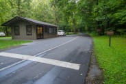
Starting Point: D-loop of Smokemont Campground off Newfound Gap Road.
Trail Traffic: I did not see anyone else while enjoying this hike.
How to Get There: From the Oconoluftee Visitor Center near Cherokee, NC travel 3.5 miles north on Newfound Gap Road (Hwy 441). Turn right at Smokemont Campground and cross Oconoluftee River. Turn left and proceed through the campground, all the way to the back of the D-loop where there are 10 parking spaces for hikers.
Most guides you will find for the Smokemont Loop hike will tell you to park outside the campground and walk through to the trailhead. Well, I wondered is that was still current procedure, so I asked a ranger. Not so fast. There are now ten hiker parking spaces within the campground at the very back of the D-loop, conveniently right next to the Bradley Fork trailhead. So save yourself a half mile of extra walking.
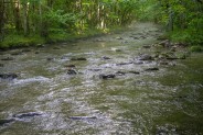
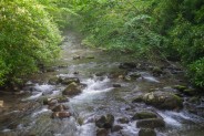
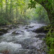
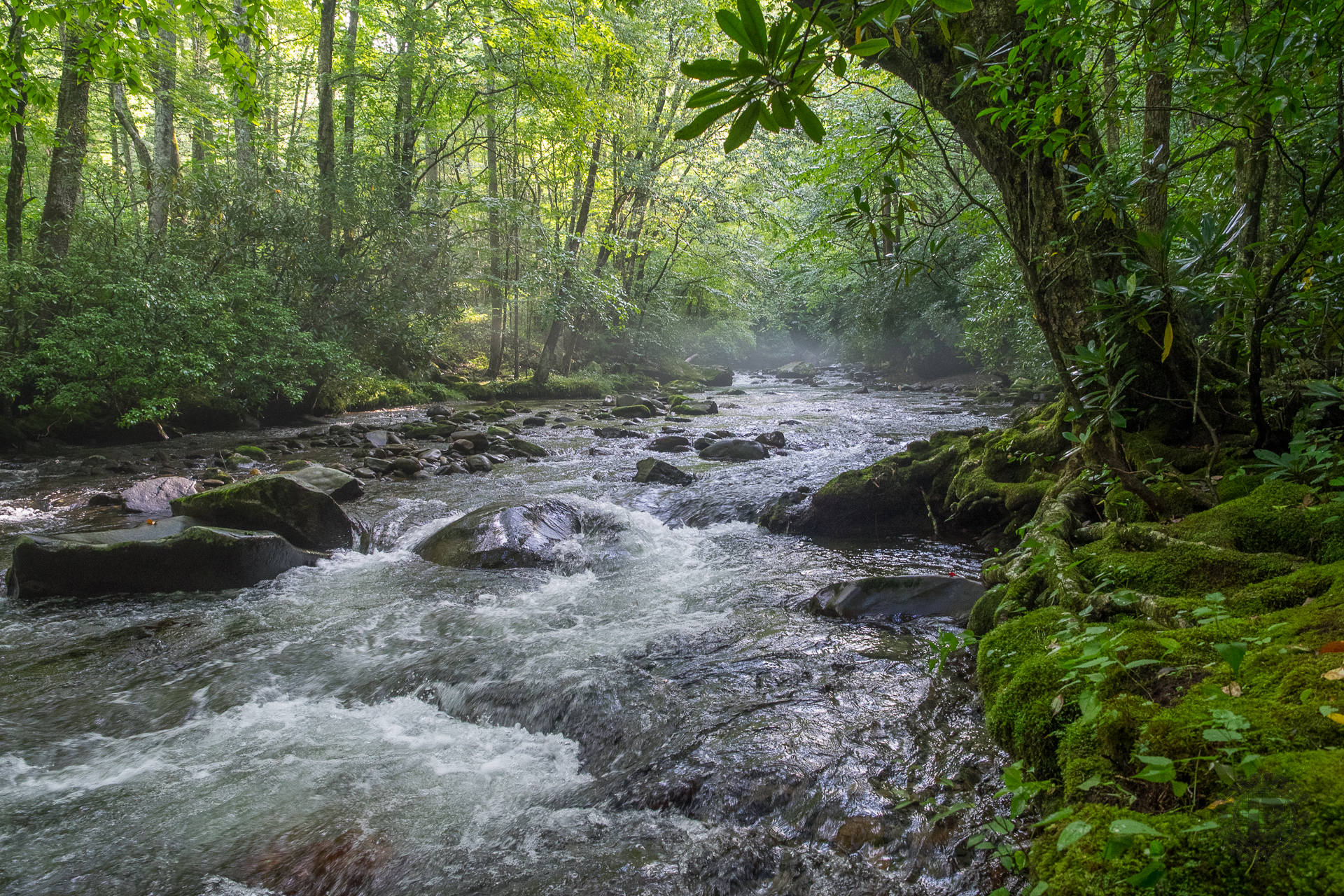
This loop hike begins on Bradley Fork Trail. It is an old roadbed that follows alongside the Bradley Fork of Oconoluftee River. The photo above at the top of this post is the river at the trailhead. You’ll be on this trail for the first 1.7 miles. It is shared by horses, but I found it to be in good shape even with all the recent summer rain. As you reach the top of the first rise, you’ll notice the trail from the stables coming in from the right.
As you follow this picturesque creek you’ll notice the occasional bench placed by the Park Service so you can sit and contemplate the natural beauty. Particularly in spring when the flowering trees are in bloom, this is a very enjoyable stroll through the forest. Just past a mile, you’ll cross over a foot bridge, then reach a junction with the Chasteen Creek Trail. There are plenty of other sights to see up there, but to stay on target for the Smokemont Loop hike, you want to take the left trail to remain on Bradley Fork.
The road winds through a low area in the forest where you can tell the creek occasionally overflows its banks. The Smokies are known for the wealth of water, and like most trails here, it is apparent there is no shortage in the Smokemont region. There is also no shortage of advantageous viewpoints for creek photography. I found myself stopping frequently trying to capture the early morning mist that was rising from the stream.
At the 1.7 mile mark you will reach the junction with Smokemont Loop. If you continue on Bradley Fork, the trail will take you on to Cabin Flats deep within the forest and to some of the backcountry campsites.
However, for this hike you want to drop down over the left side of the berm to the footlog over Bradley Fork. This is one of the longer footlogs in the park, and like most it is covered with moss, so watch your step when it’s wet. A spider had woven its magic along the hand rail on the morning I was there. On the far side of the bridge is the beginning of the Smokemont Loop Trail.
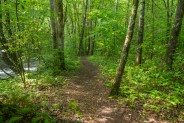
Once safely across, the new trail heads south, paralleling the creek for a hundred yards or so, crossing another short footlog just before turning right and beginning the long, tiring ascent. The trail never does get particularly steep, but you will be going uphill continuously for almost three miles. It’s definitely enough to get your attention.
Another thing I was battling by doing this hike in August was the muggy, humid air. Especially in the lower part, near the river, the air was simply wet. The trail was damp, even the plants alongside were sweating. There were plenty of mushrooms and other fungus around to remind me this is basically a rainforest.
The lower climb is a mixed hardwood forest. I’m told that in spring and early summer this trail is carpeted with disparate wildflowers including iris, indian pipe and wintergreen. The soil is certainly perfect for it. You might also enjoy the leaf peeping season as there are plenty of maple and poplar around to put on quite a show.
After about a mile of climbing the forest changes somewhat to include some evergreens, and lots and lots of laurel. For several long stretches you’re literally walking through a laurel and rhododendron tunnel as the trail hangs on the ridge. The earth also begins to dry, so the footing is less squishy.
What the drier ground also brought was daddy long legs. They were everywhere. Each time I stopped for a breather, I would see another dozen of them crossing the trail. Don’t know what it is that attracts them here, but there sure are a lot.
As you round a turn half a mile later, you’ll pass from the east to the west side of the ridge, and immediately notice the highway noise. Newfound Gap Road is directly below, albeit nearly a thousand feet, but you can definitely hear the roar of the Harleys and the whine of tires on the pavement.
Winter season, or at least late fall, is the best time for long distance viewing here. I couldn’t tell, because the leaves were still on the trees, but the ridge you’re on is surrounded by the primary Smokies crest. If vistas are your thing, consider tackling this hike when the forest is clear. You won’t sweat as much either.
When you reach about a hundred yard flat stretch, know that you are about to begin one last uphill pull. It does get steeper, but still not overly so, and the climbing goes on for another mile. When I finally topped the ridge at a switchback turn, I was extremely grateful for the strategically placed log that was perfect to take a load off. It was time for lunch… and to give the lungs a break.
As I enjoyed my lunch, and wiped the perspiration from my brow… and my arms… and my legs… and my back… and… apparently my aroma attracted some very unwanted visitors. I soon learned why the AT thru hikers always complain so much up in New England about the BLACK FLIES! Those suckers are relentless, and they hurt. They bite, and then they bite again. Then, just for good measure, they will bite you again.
I finished my food in a hurry and mounted back up to get away. Thank goodness the trail was now heading downhill and I was able to move quite a bit faster. Unfortunately, though, to no avail. The flies continued to follow me for at least a half mile, biting all the way. These things are about three times bigger than a common house fly. Did I mention they hurt?
You’re back on the east side of the ridge now. The forest is thicker, and older. There isn’t really much to comment about on the way down. There really aren’t any landmarks. I crossed an occasional seep, but mostly I simply made good time as I found my way around and down for approximately two miles.
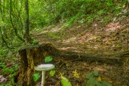
About a half mile from the campground the trail reaches the river valley level again and turns back into a road. There is an old homestead site here, but I didn’t see it because of all the overgrowth. Again, this would be more appropriately viewed when it isn’t summer. There is a cemetery here too, a short walk from the river. There are about 40 graves, dating from the late nineteenth century.
Once you cross a bridge over Oconoluftee River, you are back at the campground, at the RV dumping station. You still have to walk a quarter mile through the campground to get back to the parking at the end of D-loop.
In summary, I thoroughly enjoyed the beginning of this hike along Bradley Fork. It is quite scenic, and would make an excellent out and back hike for someone only interested in following a Smokies creek for a couple miles. The Smokemont Loop portion of the hike didn’t do much for me though. It’s fair to say that I was probably there during the absolute worst season. I recommend you don’t do this loop during the muggy, buggy summer. I will likely give it another go in spring sometime.


The following are paid links. As an Amazon Associate I earn from qualifying purchases.
 I am Jeff Clark, founder of Internet Brothers, producer of this blog, and passionate about hiking. I live in Western NC near the Blue Ridge and Great Smoky Mountains. Pisgah and Nantahala National Forests are just out my door, so the content will focus on these areas, but let me know what you would like to see on the site.


Copyright © 2011-2023 Internet Brothers. All Rights Reserved. ISSN 2324-6057
Designed by Elegant Themes | Powered by Wordpress | Logo by Design Aspirations


2 questions (not directly related to this post but I don’t know where else to ask):
1. Have you considered writing a blog post about your choice of camera? I’m curious what steered you towards the Olympus E-M1?
2. Are you using a dedicated GPS unit or smartphone? Does Trimble Outdoors allow you to edit (redraw) parts of the GPX track?
1) About the camera, I was getting tired of lugging a dSLR around, particularly on some of the more difficult hikes, so I looked into the Micro 4/3 format. I read lots of reviews, compared spec sheets of several brands, and chose the E-M1.
2) I use a smartphone to record the GPS tracks with Trimble Outdoors. Yes, you can edit the track once you have uploaded it to the web.
3) Feel free to use the contact link on the menu bar at the top of each page to message me anytime you have questions unrelated to a specific post.