
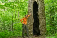
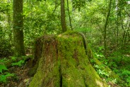
Robert “Booger” Palmer may have a silly nickname, but there’s one thing we can always appreciate him for. He never would allow loggers onto his 220 acre homestead in Cataloochee Valley. As a result, still today there is old growth forest that includes poplar trees with trunks six feet in diameter. The massive hemlocks have unfortunately succumbed to the hemlock woolly adelgid blight, but there are also many large, and still growing pines, oaks and maples. The loop starts and ends on the Caldwell Fork Trail, following the creek with the same name and its many feeder branches. I hiked this trail on Monday, June 2, 2014 beginning at 8:00AM and ending about 1:00PM. My plan was to take the Caldwell Fork Trail to the Boogerman Trail, then loop around to the other end of the Caldwell Fork Trail for the return. Sometimes unexpected surprises have a way of affecting plans.
Hike Length: 7.4 miles Hike Duration: 5 hours
Blaze: None Hike Rating: Moderate. Creek crossings and some climbing.
Elevation Gain: 1,275 feet Elevation Change: 1,005 feet
Hike Configuration: Loop, with a tail.
Trail Condition: Fair. Hazardous creek crossings. Caldwell Fork can be rocky and muddy. Boogerman somewhat overgrown in places.
Starting Point: Parking pullout along Cataloochee Road near campground.
Trail Traffic: I saw one other couple, and a family with kids.
How to Get There: From Asheville, NC take I-40 west to Exit 20, Hwy 276. Turn toward Maggie Valley, then take the first right onto Cove Creek Road. Stay on Cove Creek Rd. to the entrance to Great Smoky Mountains National Park at the Cataloochee Divide. The last mile up on Cove Creek Rd. is gravel. From the Divide it is three more miles of very curvy, downhill gravel road to the junction with Mt. Sterling Rd. and Cataloochee Rd. Turn left to Cataloochee Valley. When you reach the flat of the valley, look for the campground on your left. The trailhead is not far past the campground, also on the left.
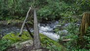
This was my third trip to Cataloochee Valley in the past two weeks. I suppose you could say I’m hooked. I timed my arrival to drive through the valley and check out the cow elk enjoying their early morning grazing. I wasn’t disappointed. However, what I did notice on my way by the trailhead was the missing bridge. Wait… What? Sure enough, the 30 foot long footlog that crosses Cataloochee Creek at the Caldwell Fork trailhead was laying on the ground parallel to Cataloochee Road. There was evidence of carpentry. Well. That sure changed things in a hurry.
I noticed a couple of park rangers at the west end of the valley out monitoring the elk with their fancy electronic gear. I asked if there was any other access to the Boogerman Trail than crossing the no-longer-in-place foot bridge to Caldwell Fork. “Yes, there is,” they said. “But you’re looking at adding anywhere from 6-10 miles to the length of your hike. The best thing to do is take off your shoes and wade the creek.”
Take off my shoes and wade the creek? Sure, I’ve done that before. But I was always prepared for it. Today, not so much. No water shoes. No hiking poles. Let’s see, do I have dry socks? Yes. Do I have a towel to dry off before putting my socks and shoes back on? Yes. What if I lose my balance, slip and fall? Do I have a change of clothes? Nope. Plus I was hiking alone on this day. No one to help me up if I did go for an unplanned swim in the cold, frothing waters of Cataloochee Creek. What would a good Meanderthal do?
What the heck! Nothing ventured, nothing gained. If you’re gonna be dumb, you better be tough… and all that rot. I came all this way to hike the Boogerman Trail. So I took the plunge. Little did I know, this was just the beginning.
I rolled up my pant legs, took off my shoes, then socks… tied the laces together and hung them around my neck. The crossing was just what I expected. The water was extremely cold, even in June. At least they had strung a rope across the creek to hang onto for balance. That proved to be extremely helpful as the rocks beneath the rushing water were both slippery and pointy. It was hard on my bare feet, not being accustomed to this, and all. Aww, poor baby.
I managed to stay upright all the way across. When my feet came out of the water and hit the warmer air there was an immediate rush of intense pain from the combination of pointy rocks and cold, cold creek. I rushed to dry them as quickly as possible, get my socks and shoes back on, and hope to get some sense of normal feeling back. Thank goodness that was over. {cough*cough}
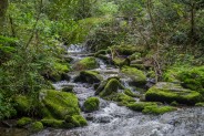
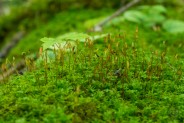
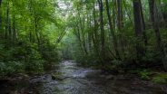
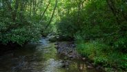
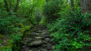
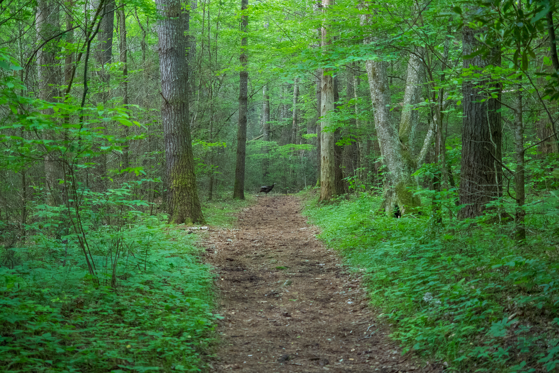
The first 0.8 mile of this loop, the Caldwell Fork Trail follows Caldwell Fork past the remains of what was once a majestic hemlock and pine forest. Many of the pines still stand, but unfortunately all that remains of the hemlock are the grey ghosts. These too will soon fall to join their brethren as food for the moss and lichens and creepy, crawly things on the forest floor. I was treated to a couple wild turkeys crossing the trail. That’s the photo at the top of this post.
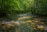
There are a few nice spots along Caldwell Fork for photos, including where Den Branch tumbles into it from high above on Den Ridge. I was settling into my hike nicely — even with some nice smooth jazz as I was testing a bluetooth speaker — when suddenly there was a crossing at the confluence of Palmer Branch and Caldwell Fork. And guess what? No bridge… again. I don’t know if there ever was a bridge here, hard to tell, but it meant it was time to do the shoes and socks song and dance once more. Oh wait! Make that at least three times more because I would have to do it again on the way back.
No friendly rope for support on this crossing, but at least it was only half the distance of the first. Again, I made it without incident, but suffered the discomfort of cold, bare skin until I could get my tootsies back in the nice warm socks. How I wish I had my water shoes with me. Live and learn, right?
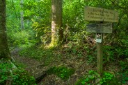
No more than a hundred yards beyond the crossing is the junction with Boogerman Trail. I chose to do the loop in a clockwise direction, so I turned left onto Boogerman, knowing that I would be returning to this spot on the continuation of Caldwell Fork later in the hike.
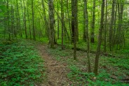
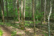
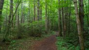
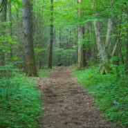
The Boogerman stretch of this trail is roughly four miles. It wanders around the former property of Robert Palmer and climbs a thousand feet over the course of 2.5 miles, a moderate grade. Because this is a hikers only trail, it is not as wide as Caldwell Fork, and it is surrounded by considerably more dense forest. At times, the ground cover even encroaches on the path itself. I would imagine as the summer trail traffic increases, the additional footsteps will help with that.
Legend has it that Robert “Booger” Palmer obtained his nickname in school. The teacher asked all the students what they wanted to be when they grew up, and Robert answered, “the bogeyman.” Apparently it stuck. Now, I don’t know about you, but I think that’s a load of horse hockey. If you ask me where he got his nickname, I say he liked to pick his nose… a lot.
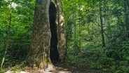
Whatever the genesis of Booger’s nickname, I think we all can agree that not allowing loggers on his property is a legacy he can be proud of. While many of his contemporaries sold out to the logging interests, Palmer stuck to his guns. He was a forward thinker who understood that trading natural resources for instant gratification is a losers endgame. As a result, you and I are now able to enjoy the many old growth gentle giants along the trail that rightly carries Booger’s name.
Unfortunately, the forest looks entirely different today than it did in the 1930s when Great Smoky Mountains became a national park. Chestnut blight wiped out those beautiful, stately giants in the 1950s. The hemlock woolly adelgid has destroyed the native eastern hemlock forest. The pines are left, as are the poplars and basswood, to give us a hint of what Den Ridge and Palmer’s homestead were like. Watch for them as you traverse the trail.
Along the way, the Boogerman Trail crosses Den Branch and Sag Branch, but unlike Caldwell Fork, these are all very easy rock hops. There are also occasional springs and seeps that trickle across the trail, creating just enough of a hazard to keep you on your toes. The final 200 feet of the climb is the steepest, but still not enough of an effort to make you huff and puff.
On the downward side of Boogerman, you will begin to notice the ruins of Palmer’s homestead. The first stone wall you come upon is at least 100 feet in length. Though the rocks are now covered in moss and dried leaves, the solid nature of the remnants is a testament to the quality of workmanship exhibited by the Palmers. Look for several of these stone wall ruins as you descend along Snake Branch.
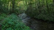
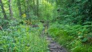
Seemingly out of nowhere, you will come to the end of the Boogerman Trail, and its rejoining with Caldwell Fork. Take a right turn to head back north. It is now two miles back to the north junction of the two trails. It’s immediately apparent you’re back on multi-use trail. It’s wider, rockier, and muddier. I’ve read reports that the Caldwell Fork Trail can be a literal quagmire after a solid rain. What it was also on this day was a genuine wildflower garden.
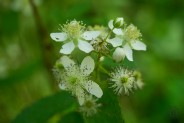
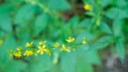
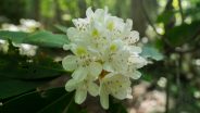
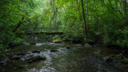
The mountain laurel was in peak bloom. I saw buttercups, blackberry, cinquefoil and daisies. The trail zigzags back and forth across Caldwell Fork nearly a dozen times, but in each case over a narrow footlog bridge. Just be sure to watch your step. Some of these bridges have lichen and algae growing, so they can be slick. Take your time and you won’t end up in the drink.
There is one particular place that is a little dicey. Curving with a series of small rapids in the creek, the trail (or lack thereof) follows alongside the far left edge. I had to skooch over boulders, and slide on my behind, hoping the trail was further ahead. After about 25-30 feet of this, the trail reappeared around the corner and continued as normal.
I’m not a fisherman, but they say there are a number of great trout pools along this stretch of Caldwell Fork. I can see where it would be total nirvana to wade out into the creek, casting a fly, surrounded by the green forest and the rrruuussshhh of the mountain stream. I was certainly enjoying the sights and sounds offered by the magnificent forest and splendid water scenery.
I was awakened from my reverie by a very nice couple coming the other way who seemed to be lost. We were at a creek crossing and they acted as though they had been hiking in circles. They had a very small map of the area and asked if I knew how to get to the Boogerman Trail. They were very friendly, but somewhat discombobulated. I pointed out on their map how they had passed the first Boogerman junction, and that the southerly one was another mile and a half ahead. I warned them that they would have some wet creek crossings, and they said, “No problem. We’ve already been through four.”
We parted company, them now confident they knew where they were going. As I walked away, I replayed that last sentence in my head. “Been through four.” Wait a minute. I only knew of two on the way back. Did this mean there were even more? Curses.
With me now wondering how many times the shoes and socks would be coming off between now and the finish, my steps were a bit more trepidatious. Each time I came to a creek crossing I wondered if there was a bridge, or not. My luck was running pretty good it seemed. The first three all had a bridge. Then I rounded a bend and standing in front of me was the mooring, but no log.
This looked to be the deepest crossing yet, perhaps 24 inches. I went down to the horse crossing to see if it was a bit easier. No such luck. I was beginning to wonder when I was about due for a drenching on one of these wades. This looked like a likely candidate. The current was pretty swift, the length only about 18 feet, but the far bank could have been a mile away.
Into the chilled water I tip-toed. I could tell instantly the current was stronger here. Without any poles for balance, I tried to keep a wide base with my legs as I inched forward across the piercing cold. Rather than small pointy stones, the bed here was slabs, making them all the more slick after centuries of smoothing by Caldwell Fork. When I made it safely to the other side, I said a big “THANK YOU!” to whoever might be listening, and treated myself to lunch.
There was a small beach on the far side that was perfect as a resting place. While devouring my sandwich, I contemplated the wet crossings that still remained. The two I knew of would be easier than the one I just finished. But that couple had said four. Was there still another that I had yet to get to?
As it turns out, all the remaining crossings had intact bridges. So the couple I had met had either miscounted, or they had gone across the same one twice while they were lost. That was a relief. When I got back to the crossing at the confluence of Palmer Branch and Caldwell Fork I already knew what I was facing. Believe me, I didn’t get too cocky. I still didn’t want to end up submerged on this day.
After safely navigating the crossing, I only had 0.8 mile back to the end on the portion of Caldwell Fork Trail I had already hiked. I encountered a young couple with three very young children in swimsuits and bare feet who looked like they were excited about these challenging forays across the creek. Ah, youth. The attitude of this 61-year-old man vs. their enthusiastic naiveté made me chuckle as I wished them a pleasant day.
I made it back across Cataloochee Creek again without falling. I was frankly amazed at my good fortune. If you’ve been a long-time reader here at Meanderthals, you would know that creeks are my nemesis. I’ve had three memorable falls into creeks just in the three years I’ve been writing these reports. I was very grateful that on this day I did not add to that tally. With a total of five wet crossings, I surely was pressing my luck.
To summarize, the Boogerman Loop would be a very nice woodsy hike through old growth forest and along refreshing mountain streams. The missing foot bridges, however, added quite a bit more excitement that I was expecting. It also adds time. I suspect this hike would take me an hour less without the wet creek crossings. If I had been prepared properly, it would have been a different matter. The large crossing right at the beginning will obviously be repaired. In fact, by the time you read this, it might already be. The other two, though, I don’t know. It looked like the original bridges had washed away, so repair would be more significant. My advice: bring water shoes just in case.


Update August 3, 2016: Time for another visit to this delightful loop through the woods of Cataloochee Valley, and time to check the latest status on the footlogs across Caldwell Fork. I’m happy to report that the new bridge across Cataloochee Creek at the trailhead is likely the most sturdy in all of Great Smoky Mountains National Park.
The others, however, are still missing. There are four wet creek crossings of Caldwell Fork, and a couple of other still intact footlogs that look like they could go too with the next really hard rain. This time though, I was prepared with water shoes and neoprene socks. It made this trek so much easier and more enjoyable.
I took the advice of a Facebook commenter and tried the loop in the opposite direction this time, and would have to agree that it seems a bit easier in a counter-clockwise direction. The Caldwell Fork Trail can still be quite muddy in places primarily due to horse traffic, but the Boogerman Trail is mostly in excellent condition. When looking at the new photo gallery below, see if you can tell the difference in season.


The following are paid links. As an Amazon Associate I earn from qualifying purchases.
 I am Jeff Clark, founder of Internet Brothers, producer of this blog, and passionate about hiking. I live in Western NC near the Blue Ridge and Great Smoky Mountains. Pisgah and Nantahala National Forests are just out my door, so the content will focus on these areas, but let me know what you would like to see on the site.


Copyright © 2011-2023 Internet Brothers. All Rights Reserved. ISSN 2324-6057
Designed by Elegant Themes | Powered by Wordpress | Logo by Design Aspirations


`Hiked The Boogerman Loop Trail on 6/13/15 and the trailhead bridge is back in place. The other bridges are still missing which makes for quite an adventure. About 24 rock hop, muddy patches or deep water crossings as it did rain the night before. You will get your shoes wet. We switched to water shoes at the first water crossing & left them on the balance of the hike. Started with a bull elk checking us out thru the car window on the way in to a fallen tree across the road on the way out.
You will need water shoes and a stick. This is not a safe trail for small children at this time.
All this made this hike a real blast!
Thanks for the update Dennis.
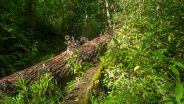
Hiked it on 7/31/16. Trailhead bridge is in good shape. The crossing before the 1st Boogerman intersection is still a rock hop. There are a few blowdowns along Boogerman trail but nothing you can’t step across. Coming back down Caldwell Fork from the upper intersection was a quagmire in places where the horses have it rutted. Bridges are still out in a couple of places. I could rock hop two of them but at one point it was either boots off or wade across and walk them dry. As it was beginning to rain, I went boots on and kept trucking.
Thanks for the update James. I plan on revisiting this trail myself soon.