
Hiking among the giants of the East. That’s what you’re doing when you take the Blue Ridge Parkway to Mt. Mitchell State Park for this trek on the Mountains to Sea Trail in the Black Mountains. With fabulous views of the Blacks and the Great Craggy Range, and closeup experiences with gnarly old growth fir and spruce krummholz, this stretch of the MtS is some...
Learn More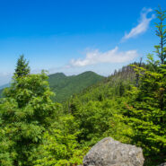
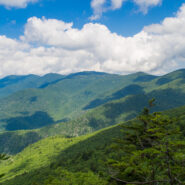
This hike will introduce you to a good cross section of the trails found in Mt. Mitchell State Park high atop the Black Mountains in Western North Carolina. Mt. Mitchell is the highest point in the Eastern United States at 6,684′, in fact six of the 10 highest peaks are found in the Blacks. The climate of the Black Mountains is more like Canada than North Carolina....
Learn More
The Cosby area in the Smokies offers quite a few long and rugged hikes from valley floor to mountain tops, including this leg-wrecker from the Cosby Campground to the Appalachian Trail on the Snake Den Ridge Trail. Even up top there are multiple potential destinations. We chose Inadu Knob and the old search & rescue helicopter pad at Deep Creek Gap for the views...
Learn More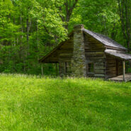
Little Cataloochee developed as an expansion to Cataloochee Valley with many of the sons and daughters of the original founders spreading their wings, albeit just a few miles away. Travel these days is limited to hiking boots and horseback, but a sense of time and place is still available through the historic restorations made by the National Park Service. Little...
Learn More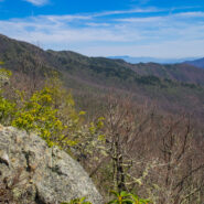
Backcountry wilderness. If you really want to get a taste, then this hike is for you. Starting at the remote Camp Daniel Boone, the northern terminus of the Art Loeb Trail enters Shining Rock Wilderness immediately. As you begin the nearly 2,000′ ascent to Deep Gap, on the southern shoulder of Cold Mountain, you will cross numerous streams as you hike through...
Learn More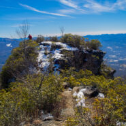
Pinnacle Park is an 1,100 acre tract of land owned by the town of Sylva in Jackson County, NC that was previously used as the community watershed. In 1991 it was leased to the Pinnacle Park Foundation for developing hiking trails that pass by streams, waterfalls, and beautiful long distance vistas. The Pinnacle, where the park got its name, is a large rocky outcropping...
Learn More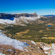
Acrophobia? Then you may want to stay home for this one, or at least don’t go all the way. That was my choice when my life-long fear of heights (that I thought I had conquered) kicked in. Devils Causeway, the destination for this hike on East Fork Trail in Flat Tops Wilderness, is an extremely narrow backbone atop a rocky ridge named the Chinese Wall that drops...
Learn More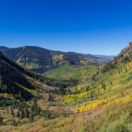
Beginning on Columbine Dr. in East Vail, CO, the Bighorn Trail climbs steeply out of the Vail Valley, then more gradually climbs up through stands of aspen and pine. The trail passes beaver ponds and the remains of old mining camps as well as Bighorn Creek. Near the halfway point, be sure to turn around because the views of Vail and Bighorn drainage behind you are...
Learn More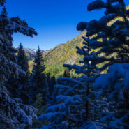
Booth Lake Trail begins at Booth Falls Road in East Vail, CO and ends at Booth Lake. The trail climbs up the Booth Creek valley through mostly aspen groves before passing the 60-foot Booth Falls. Beyond the falls the trail winds through conifer forests and meadows filled with wildflowers. Above 10,000 feet the trees thin and the terrain changes offering views of the Gore...
Learn More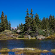
One of the things I miss about the Blue Ridge and Smokies is mountain lakes. The Rocky Mountains are adorned with memorable alpine lakes, usually surrounded by majestic peaks and bountiful evergreen forest. All you need is an input and output source, like Fall Creek in the case of Lake Constantine, and a bowl between mountains to collect the water. Fall Creek Trail...
Learn More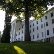
Nestled in the beautiful Blue Ridge mountains near Asheville, North Carolina, YMCA Blue Ridge Assembly is a full-service conference center situated on 1,200 acres of woodland beautified by mountain streams, wildflowers, ridges, valleys and spectacular views. What is little known about the property is the extensive hiking trail system. Primary among these is the High...
Learn More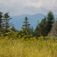
Most people who head out Clingmans Dome Road in Great Smoky Mountains National Park are there to climb the half mile to the summit of the 2nd highest mountain in the East. But here at Meanderthals, we aren’t most people. Below Clingmans Dome are trails that explore the ridges and drainage on the south face. Included among those are Forney Creek Cascade, a classic...
Learn More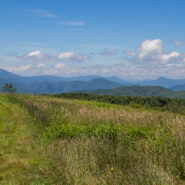
High above the community of Erwin, Tennessee, the Appalachian Trail follows the North Carolina / Tennessee state line through the Unaka Range. From a grassy bald ridge with the appropriate name Beauty Spot, to the summit of 5,184′ Unaka Mountain, the trail winds northeasterly for a 4-mile section through a continuously changing ecology. Stand on the bald with...
Learn More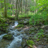
Looking to do some ridge hiking down, down, down from the Blue Ridge Parkway into Pisgah National Forest? Overlooking North Mills River, the Little Pisgah Ridge starts at 4,800′, then drops down into the Big Creek drainage some 2,100 feet below. Catch your views of the mountains on the Parkway before you start because this is a heavily forested hike that instead...
Learn More
Hiking a state line offers interesting boundary markers and competing blaze markings. This hike on the Foothills Trail follows the boundary from the highest point in South Carolina — Sassafras Mountain — to a convenient end point at Gum Gap in North Carolina. Because of the length, for us this was a two vehicle hike, with one left at each end. Expect a roller...
Learn More
Cedar Rock is one of several granite pluton monoliths found in the Davidson River area of Pisgah National Forest. More difficult to get to than its nearby brethren, Looking Glass and John Rock, Cedar Rock has outstanding long distance views from both the east and west sides of its summit. You will have to work to get there, climbing nearly 1,700 feet from the valley...
Learn More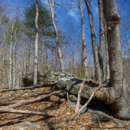
Perhaps you’re looking for a short hike that will really stretch your legs and get your heart pounding. Then you may want to consider the Pressley Cove/Maxwell Cove loop that is not too far from the Pisgah Ranger District headquarters. You’ll climb more than 1,400 feet in just a little over a mile through a beautiful poplar, oak and beech one-age forest....
Learn More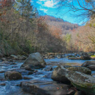
Green River Game Lands, southeast of Hendersonville, NC, sits astride the Henderson/Polk County line. Paralleling the Green River Gorge, the Game Lands is a state owned tract of more than 10,000 acres with 16 miles of hiking along nine distinct named trails. As its moniker would imply, hunting, fishing, and trapping are allowed on the Game Lands during the months of...
Learn More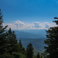
Crowning the Mount Sterling Ridge, 5842 foot Mount Sterling is another of the tall peaks that give the Great Smoky Mountains their character. Located in the far eastern area of the national park in North Carolina, the 7-mile Mount Sterling Ridge rims the scenic Cataloochee Valley to the southeast. There are trails to the summit of Mount Sterling from every direction, but...
Learn More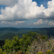
Pilot Mountain stands 5084 feet above the western edge of Pisgah National Forest, near the Blue Ridge Parkway and Looking Glass Rock. There are three ways to get to its summit, but the one I enjoy most is the section of the Art Loeb Trail from Gloucester Gap along Forest Road 475. It isn’t particularly long, but it is quite strenuous. You will get your exercise...
Learn More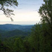
Usually when you come here you will find a cheerful description of a scenic hike that was fun, and that I recommend for your enjoyment. Instead, I am going to suggest that you stay away from this hike if you value your safety and security. The Brush Creek and Burnett Gap Trails are so terribly maintained as to make them virtually impassible. I’m sure at one time...
Learn More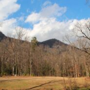
Falls Creek Falls is a double cascade in the northeast corner of the Mountain Bridge Wilderness in upstate South Carolina that free falls more than a hundred feet. In winter there is a distant view of the top of the falls from 800 feet below at the trailhead on Falls Creek Rd. From the falls, Hospital Rock Trail climbs Standingstone Mountain along Falls Creek for ridge...
Learn More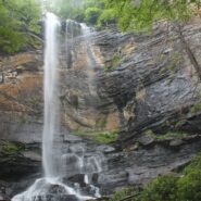
Jones Gap State Park sits on the Blue Ridge Escarpment in northwestern South Carolina very near the state line with its neighbor to the north. Along with Caesars Head State Park, these two share an area known as Mountain Bridge Wilderness. The Jones Gap Trail follows the Saluda River along an old interstate road built by Solomon Jones in the 1850s. In this backcountry...
Learn More
Thompson Creek Trail climbs Thompson Ridge from Forest Road 1206 to a point just below the Pisgah Inn on the Blue Ridge Parkway. To the southwest it overlooks the Cradle of Forestry National Historic Site and the Pink Beds. To the east it crosses from Transylvania County into Henderson County and joins the Pilot Rock Trail along the Slate Rock Ridge for the descent...
Learn More
Matthews Creek plunges more than 1,000 feet over Raven Cliff Falls into the gorge it has carved below Raven Cliff Mountain. One of a myriad of landmarks along the Blue Ridge Escarpment in Caesars Head State Park, this gorge offers a very challenging yet rewarding hike. Part of the Mountain Bridge Wilderness Area that also includes Jones Gap State Park, this is the most...
Learn More
Chimney Rock State Park is one of the newest in North Carolina. The state acquired the land from private ownership in 2007, and the Carolina Mountain Land Conservancy continues to obtain additional parcels in the Hickory Nut Gorge to eventually expand the state park. The Rumbling Bald section of the park is separate from the more famous namesake, Chimney Rock. Because...
Learn More
Montreat is a small community just north of Black Mountain, NC with a world renowned conference center, a college, and best for us, 20 miles of hiking trails that rival those in nearby Pisgah National Forest for quality and scenery. In particular, the Greybeard Trail is an exceptional workout that climbs more than 2300 feet to the summit of Greybeard Mountain on the Blue...
Learn More
You don’t have to climb to 6000 feet to get spectacular views of the Smoky Mountains. In fact, Mt. Cammerer has some of the best views in the national park, yet doesn’t even reach 5000 feet. You can see Snowbird Mountain and the Pigeon River Gorge to the east, and Mt. Sterling south, and the full expanse of the national park to the west. Mt. Cammerer was...
Learn More I am Jeff Clark, founder of Internet Brothers, producer of this blog, and passionate about hiking. I live in Western NC near the Blue Ridge and Great Smoky Mountains. Pisgah and Nantahala National Forests are just out my door, so the content will focus on these areas, but let me know what you would like to see on the site.


Copyright © 2011-2023 Internet Brothers. All Rights Reserved. ISSN 2324-6057
Designed by Elegant Themes | Powered by Wordpress | Logo by Design Aspirations