
The Shut-in Ridge Trail and the Mountains to Sea Trail are one as they traverse the Blue Ridge from the North Carolina Arboretum to Mt. Pisgah. Along the way, there are several jumping on and off points where you can access this trail from the Blue Ridge Parkway, enabling short day hikes. One of these short sub-sections is along Bent Creek Gap Road at BRP milepost 400. From there it’s a steep climb of 1.4 miles to an old fire tower location on Ferrin Knob. Ken and I visited this little corner of the Blue Ridge Parkway on Tuesday, February 14, 2017 beginning at 9:30AM and ending about 11:45AM. Our plan was to take Shut-in Ridge Trail from Bent Creek Gap Road to Ferrin Knob, then return.
Hike Length: 2.75 miles Hike Duration: 2.25 hours
Hike Rating: Difficult. Climb averages 575 feet per mile. Strenuous.
Hike Configuration: Up and back Blaze: White
Elevation Change: 825 feet Elevation Start: 3,208 feet
Trail Condition: Fair. Sections are quite rocky making downhill somewhat unstable.
Starting Point: Mountains to Sea trailhead on Forest Road 479 below BR Parkway.
Trail Traffic: We had the trail all to ourselves on this mid-February day.
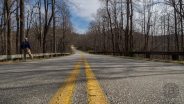
How to Get There: Take the Blue Ridge Parkway to milepost 400 and look for Forest Road 5000, otherwise known as Wash Creek Road. You can also come up FR 5000 from North Mills River in Pisgah National Forest in season. Alternatively, you can come up Forest Road 479 (Bent Creek Gap Road) from the Lake Powhatan Recreation Area. The trailhead is below the Blue Ridge Parkway overpass.
I had been to this section of the Mountains to Sea Trail once before, many years prior, when popping onto the Blue Ridge Parkway from the Bad Fork Trail. That hike came up from below in North Mills River. This time we chose to start on the Parkway since there was plenty of climb ahead of us on Shut-in Ridge.
The Shut-In Ridge Trail is part of Pisgah National Forest history dating all the way back to the George W. Vanderbilt days. Originally, around 1890, this passage was created by Vanderbilt to link his Biltmore Estate home with his hunting lodge at Buck Spring near the current Pisgah Inn and Mt. Pisgah trailhead.
While many think of this trail as following the Blue Ridge Parkway, it’s actually the other way around, since the parkway wasn’t built until the 1930’s. Since it does parallel the parkway (as does much of the Mountains to Sea Trail in the mountains), it has certain benefits, not the least of which is you’re never very far from help, or changing your mind.
The full length of Shut-in Ridge Trail follows the series of ridges from the French Broad River and NC Arboretum (BRP mile marker 393) at about 2,000 ft. elevation, to the Pisgah Inn (BRP mile marker 408), more than 5,000 ft. high. This particular section from Bent Creek Gap Road to Ferrin Knob climbs from 3,200 ft. to just above 4,000 at Ferrin Knob.
The trailhead is essentially under the Blue Ridge Parkway at Bent Creek Gap. Forest roads 5000 from North Mills River and 479 from the Bent Creek area of Asheville meet under the BRP at parkway milepost 400.3. Head east and down to go to Cold Knob or head west and up for this hike to Ferrin Knob.
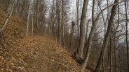
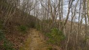
After a hundred yards you turn right onto the main Shut-in Ridge Trail. It is apparent from the width of this trail that it was once a thoroughfare for those heading for the top of the ridge at Mt. Pisgah. The trail is surrounded by hardwood forest, not particularly attractive in the dead of winter. As you will see from the photos below, everything is just brown.
For the most part the trail is a long, straight incline. Climbing at a rate of nearly 600 feet per mile, it will test your lungs, legs and hips. I paused every couple hundred yards or so for a 20 second breather. In winter, with the leaves down, you can see downtown Asheville off to the north as you get higher up the ridge.
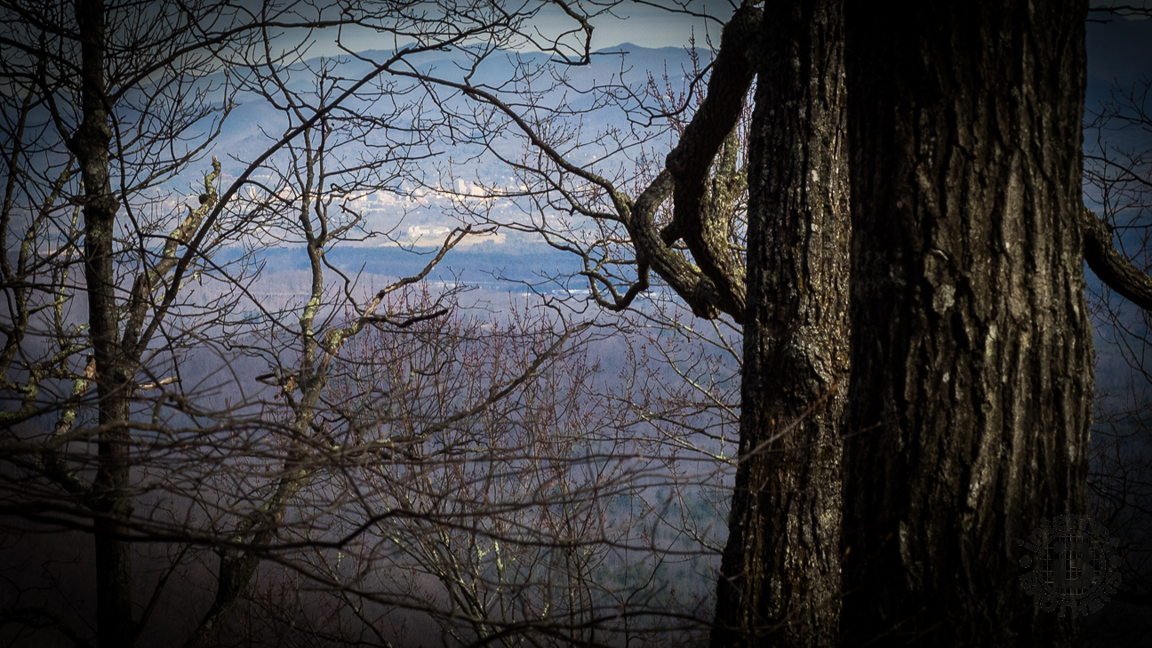
Asheville through the trees
At about 3,600 feet elevation there is finally a bit of green as the occasional mountain laurel lines the trail. Look for the beautiful pink and white blossoms here in mid-May. The trail also becomes quite rocky as it passes area of shale bedrock that have eroded over the decades. Some of the descent through this area upon return was a little dicey because of all the rocks.
At the one mile mark you reach a short, hundred yard stretch of level path followed by a trail sign pointing to the left, and up. This is a sharp change of direction. You can see the trail climbing the ridge and realize you are in for more heavy breathing. We paused here for a moment to steel ourselves for the exertion, then plowed up the hill.
Following 5-8 minutes of hard climbing, there is a switchback to the right as you join the ridge line to the summit of Ferrin Knob. There is a little more green in the forest here, even some grass in the understory. The pitch of the climb eases from the unrelenting grade to one more conducive to actually feeling air in your lungs.
It’s just another tenth mile to the summit of Ferrin Knob and the site of an old Depression-era fire tower. The Ferrin Knob tower is no longer in use but the foundation footings are still visible. Fire towers in the area were built in the 1930’s, this one in 1933, but they became obsolete as roads were built and advanced technology enabled wildfire detection without use of these remote fire towers.
We each pulled up one of the concrete footings as a seat and enjoyed lunch. The Civilian Conservation Corps guys who poured these footings apparently wanted to be remembered, as there were many names and dates carved into what was then wet cement. The one I sat on not only read 1933, but it also even had my birthday inscribed. What a coincidence.
We stayed for about 20-30 minutes talking about what it must have been like then, as we often do. There isn’t really much to see from Ferrin Knob as it is surrounded by trees, however we could make out the TV tower on top of Mt. Pisgah off to the southwest. If you continue west on Shut-in Trail, it immediately descends the other side of Ferrin Knob. We weren’t really up for going down just to climb back up again, so we headed back the way we came.
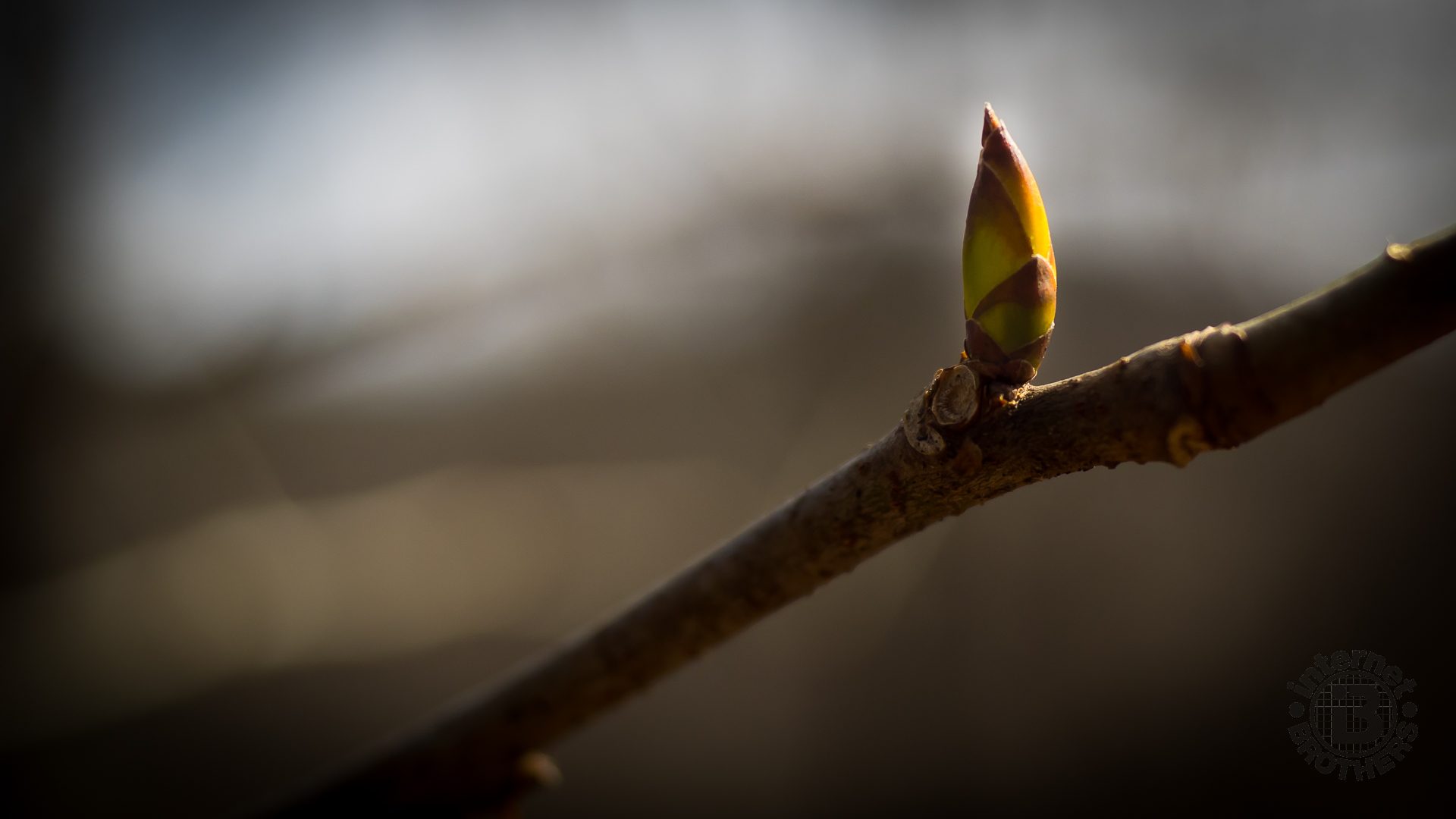
It was warming nicely now and we both shed a layer. This truly has been a very mild winter of 2017 in the Southern Appalachians. Not really anything more to observe on the way back down, other than just to remind you to be careful on the rocky trail. Don’t want to turn an ankle, or worse. What we did notice, though, were several of the smaller trees showing the first signs of buds like the one in the picture at the top of this post.
Summarizing, this hike was somewhat disappointing, though that’s certainly not the fault of the trail. We just picked the wrong time of the year to go. In February there was no color to speak of, obviously no wildflowers. Even with the leaves down the views of the surrounding Blue Ridge are mostly muted. There are no creeks to see. Consider this hike positive as a very good workout, but you may want to wait until the green season to tackle this one.


The following are paid links. As an Amazon Associate I earn from qualifying purchases.
 I am Jeff Clark, founder of Internet Brothers, producer of this blog, and passionate about hiking. I live in Western NC near the Blue Ridge and Great Smoky Mountains. Pisgah and Nantahala National Forests are just out my door, so the content will focus on these areas, but let me know what you would like to see on the site.


Copyright © 2011-2023 Internet Brothers. All Rights Reserved. ISSN 2324-6057
Designed by Elegant Themes | Powered by Wordpress | Logo by Design Aspirations
